
Living Shoreline Revitalization
Shoreline revitalization efforts were focused at the park’s southern end, which was severely degraded and actively eroding due to several factors. The 15,000 square foot project area utilizes layered restoration techniques to create a high-functioning shoreline ecosystem while also improving water access for park visitors. The revitalized conditions achieve a seamless transition between the land and water to build valuable aquatic, riparian, and upland habitats.
View Grand Opening News Conference
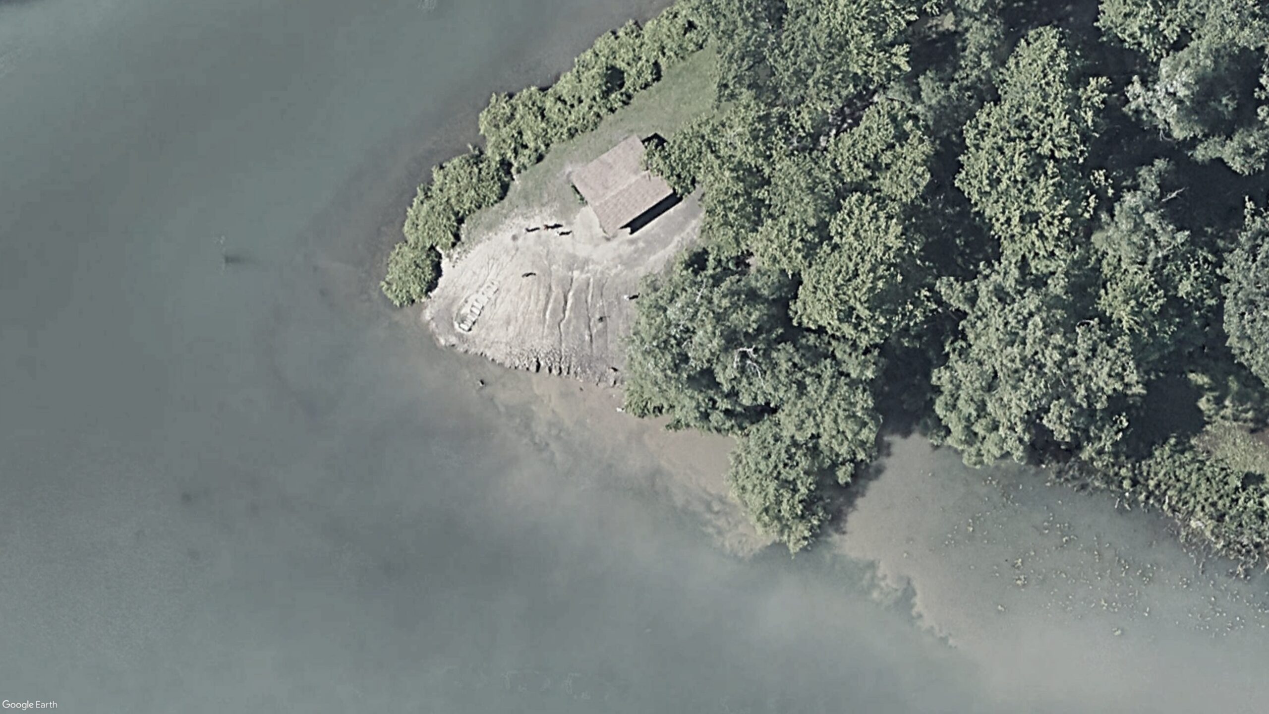
Project Area and Pre-Construction Conditions
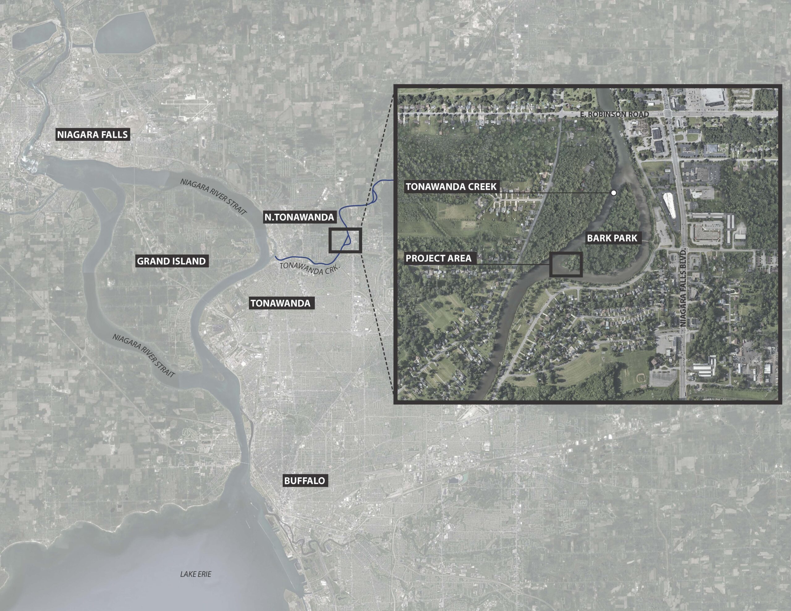
The project area is located on the southwest point of Ellicott Island Park, also referred to as Ellicott Island Bark Park, which is part of Erie County Parks.
The island is formed by Tonawanda Creek (Erie Canal), which cuts the island off from the mainland on all sides as it flows around the island towards the Niagara River Strait. The island functions as an off-leash dog park and is beloved by many in the community.
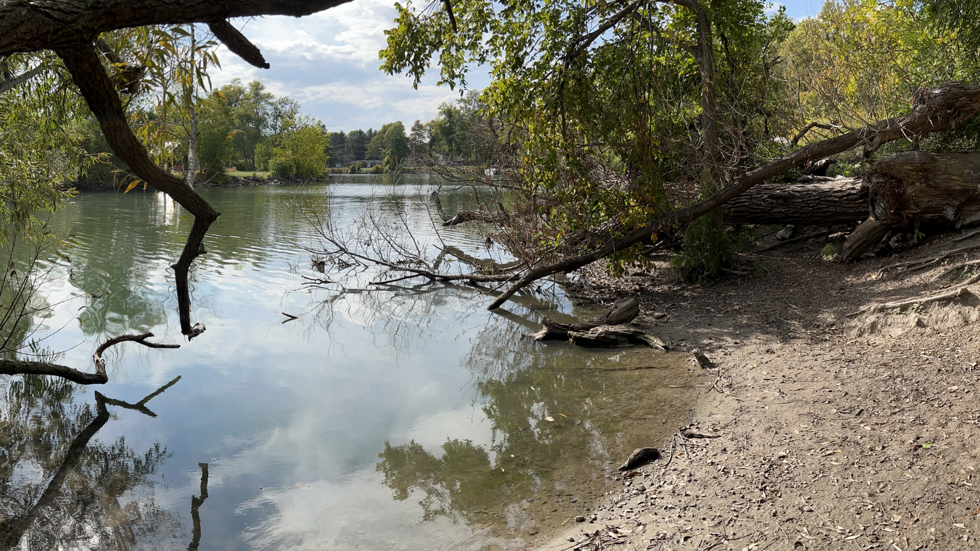
Prior to revitalization efforts, the park was experiencing riparian habitat loss, rapid shoreline erosion, and high turbidity* in shallow water areas due to several factors. High foot/paw traffic in riparian areas were resulting in vegetation loss, and persistent boat wakes throughout the summer were causing rapid erosion along the shoreline. The impacts of these stressors were most apparent, and most severe, at the southern end of the island, which became the project focus area.
*According to the United States Geological Survey, turbidity is the measure of relative clarity of a liquid. When water has high turbidity values, it means that there are a lot of suspended particles in the water column. Very high turbidity levels can negatively impact water quality, and can stress plants, fish, and wildlife living in the shallow water areas along the shoreline.
Revitalization Efforts
Construction started in Spring 2024.
Plantings were installed throughout the 2024 growing season and a grand opening of the park was held in October 2025.
The Living Shoreline design at the Ellicott Island Bark Park re-engineered approximately 15,000 square feet of shoreline and riparian area to better cope with the ongoing erosive stressors the site is experiencing. The work included:
- Stabilizing the rapidly eroding shoreline using bio-engineering techniques
- Reducing stormwater pollution and rill erosion through green infrastructure practices
- Removing invasive/non-native plant species and establish diverse native plantings
- Creating a littoral zone with conditions suitable for emergent vegetation establishment
- Reducing turbidity within project boundaries and adjacent shoreline areas by creating a stabilized water access point for dogs.
Project Design Approach and Key Features
The project design utilizes four nature-based strategies to create a functioning living shoreline along the southern tip of Ellicott Island. These design components include the installation of barrier rock reefs, soil lifts, contour swales, and a stabilized water access area to reduce turbidity at a popular access point for dogs. More detailed descriptions of the design components are provided below.
Barrier rock reefs are low profile berms made of rock.
They are installed in the water and will create protected aquatic planting zones along the shoreline. The landward side of the sills will contain special wetland planting substrates and be densely planted with wetland species, which will further improve erosion resistance and add critical habitat for beneficial insects, fish, and other wildlife.
Soil lifts (sometimes called soil burritos or soil wraps) are common bioengineering techniques used for shoreline restoration.
This area experiences frequent water level fluctuations and wave action brought on by storms and boats. Soil lifts will provide shoreline stability while woody cuttings and herbaceous plants establish. Soil lifts will be reinforced using biodegradable erosion control fabric and coir logs, which will fade away a few years after installation once the vegetation is well established.
Contour swales are passive grading techniques that reduce stormwater pollution.
Small berms are built perpendicular to the slope of the earth and function to capture stormwater runoff instead of allowing it to run downhill towards the waterbody. Capturing this stormwater before it enters the water will increase soil moisture on the slope, reduce scour and erosion caused by overland runoff, and reduce the amount of pollutants entering the waterbody from upland areas.
A stabilized water access area has been designed, which will better handle the high volume of foot/paw traffic accessing the water in this area.
This feature is intended to better define swimming areas, keep dogs outside of adjacent sensitive habitat areas, and to reinforce the shoreline to reduce erosion and turbidity in nearshore areas. The design utilizes anchored logs to contain the dogs within a defined swimming area, a wooden terraced access point to reduce erosion along the shoreline, and rounded pea gravel within the shallow water wading areas to prevent disturbance and suspension of fine sediments when dogs access the water.
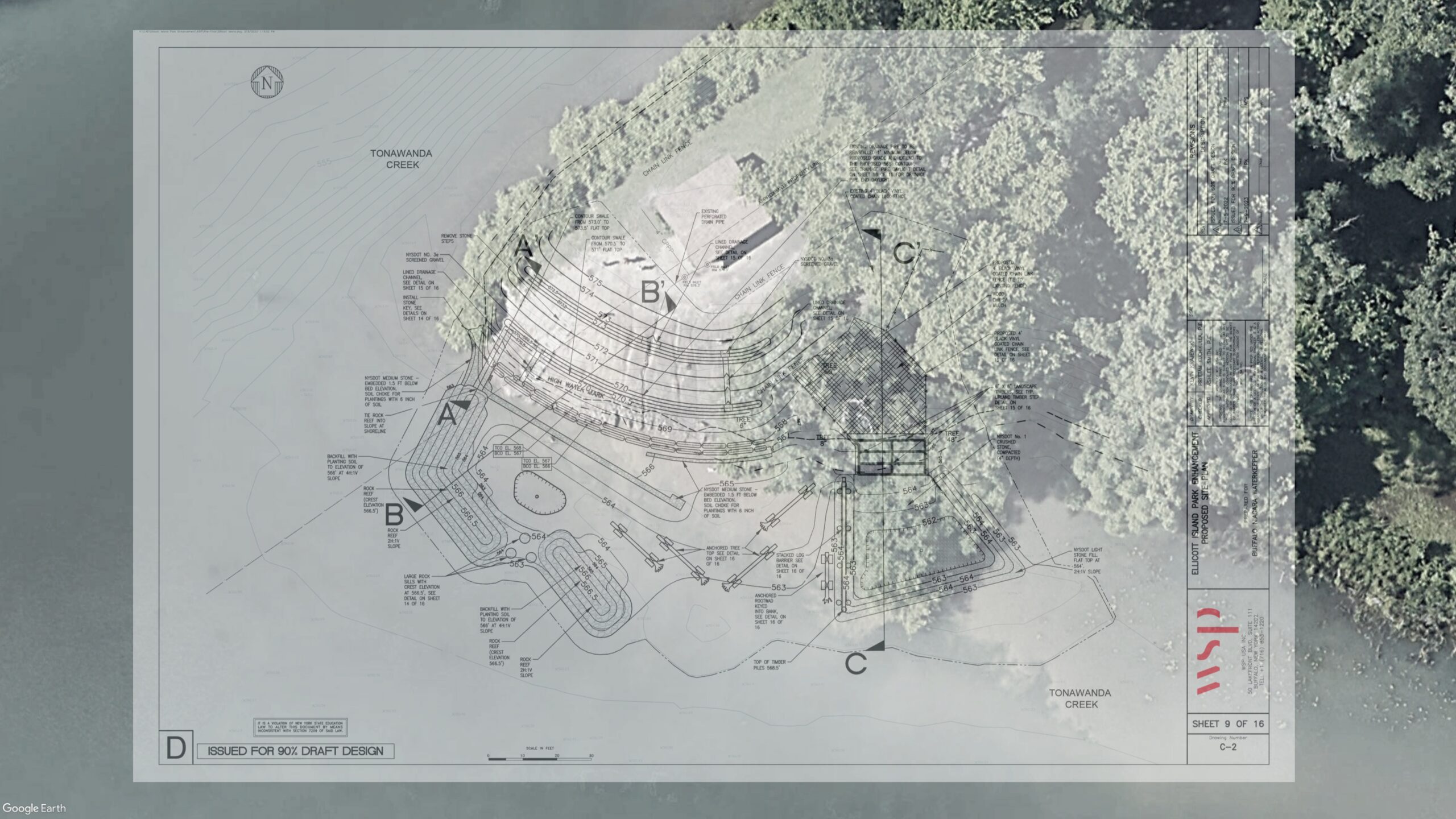
Satellite map shows construction location with an overlay of design plans.

Partners
This project was made possible by the generous support of the New York Power Authority with funding provided through the Greenway and Ecological Standing Committees. Additional support and funding provided by Erie County and through an agreement with Cornell University in partnership with New York Sea Grant under Prime Agreement CM04068 from the New York State Department of Environmental Conservation.
New York Power Authority Greenway Ecological Fund
Funder – Project Design
New York Power Authority Habitat Enhancement and Restoration Fund
Funder – Project Construction
Cornell University in partnership with New York Sea Grant
Funder – Project Construction
Erie County
Landowner and Project Funder
NYS Canal Corporation
Landowner
Friends of Ellicott
Property Stewards
WSP, Inc.
Design Consultant
LDC Construction
Prime Contractor
Restored Conditions
After project implementation and establishment, native plantings will span the land-water interface and provide a wealth of environmental services to this area. Reduced erosion, nutrient uptake, stormwater retention, and overhanging vegetation will improve water quality and help combat the algae blooms that are common in the lower reaches of Tonawanda Creek. In addition to water quality benefits, the project will also benefit the wildlife that rely on healthy shorelines to survive, such as freshwater mussels, warm water fish species, wading birds, waterfowl, beneficial insects, and pollinators.
Boulders, logs, and vegetation in the water will offer important feeding, resting and spawning grounds for fish.
Barrier rock reefs attenuate wave energy and create suitable growing conditions for emergent aquatic vegetation in shallow water areas.
Native vegetation growing in-water and along the shoreline will reduce erosion while absorbing and filtering pollutants and nutrients.
A variety of native plants not only strengthens the shoreline, but also attracts birds, bats, and frogs, which are natural predators of pest species like mosquitoes.
High diversity plantings create a dynamic tapestry of blooming plants that celebrate the regions natural heritage.
The stabilized water access point improves the park experience while reducing turbidity and shoreline disturbance historically caused by unrestricted dog activity in shallow water areas.
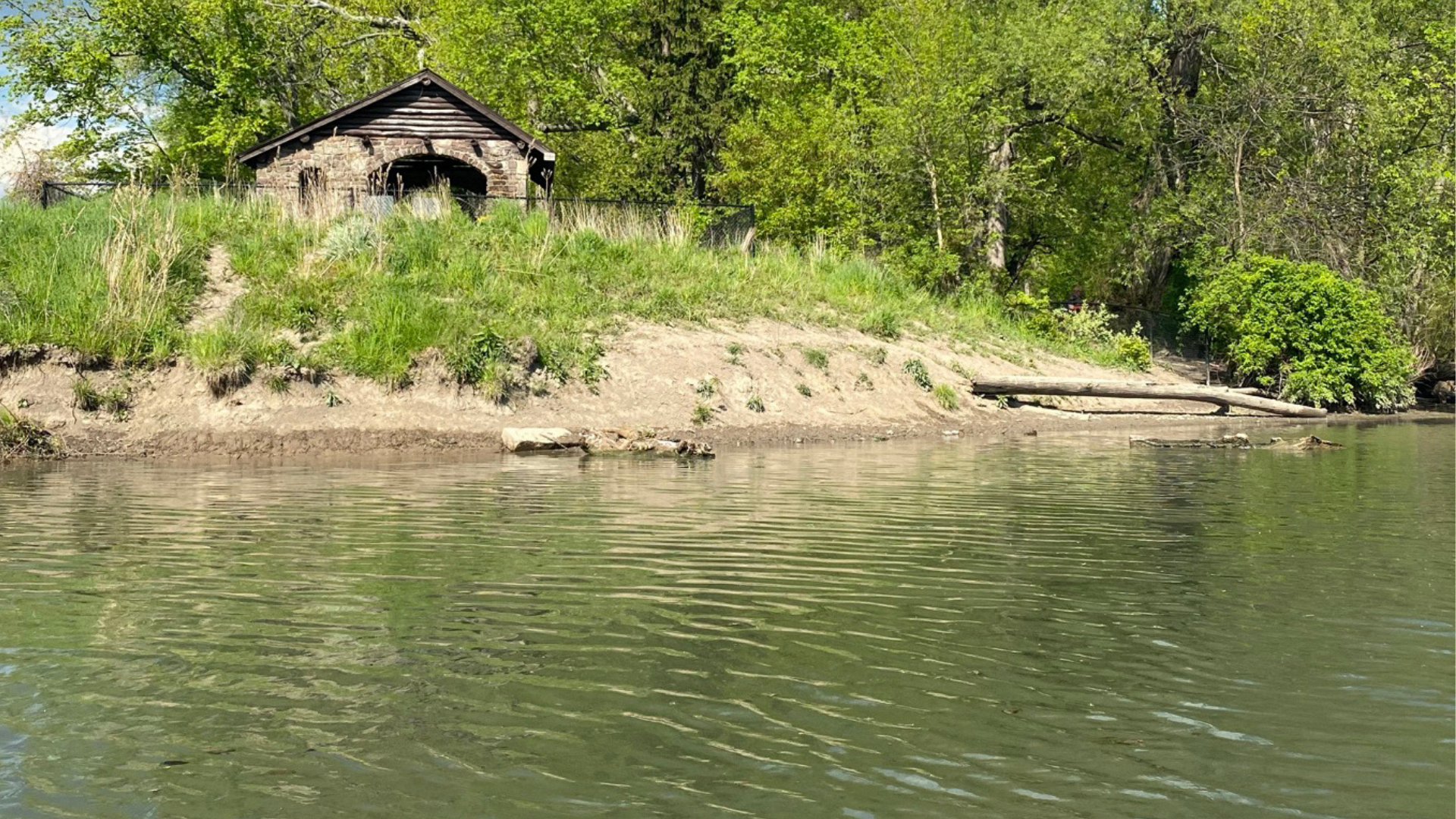
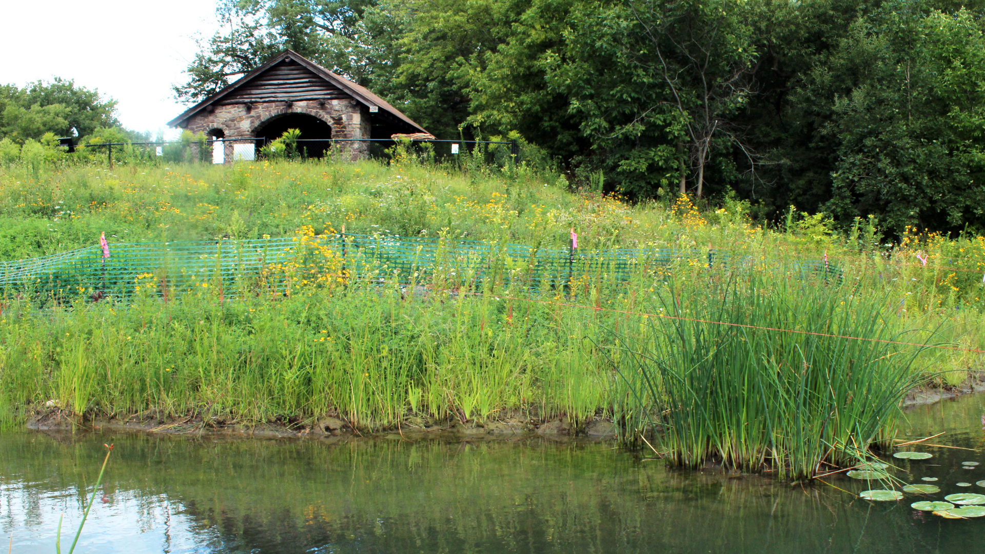
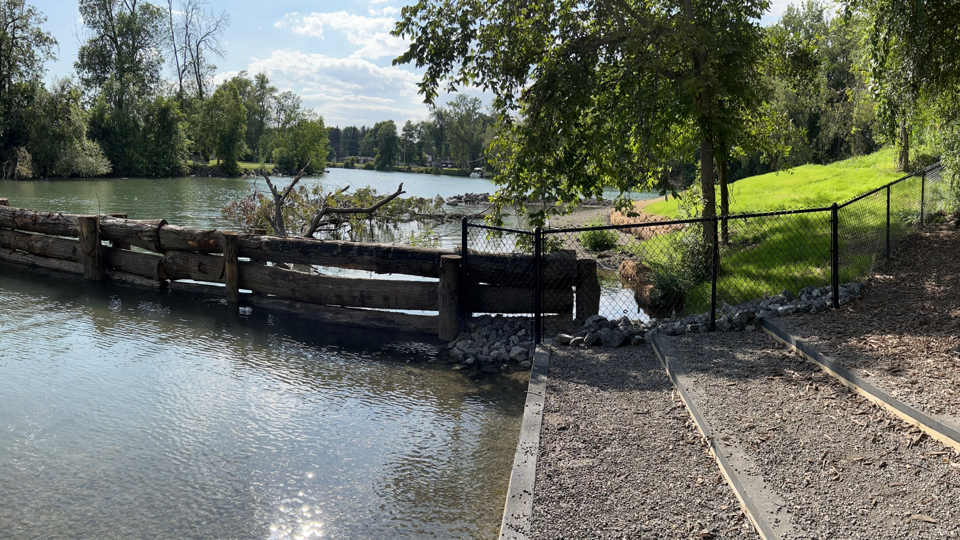
The park shelter at the top of the slope serves as a useful visual reference point, illustrating the dramatic change in plant composition before (upper image) and after (lower image) project implementation. Plant establishment observed during 2025 was particularly strong given that many species were installed during late summer 2024 and were entering their first full growing season.
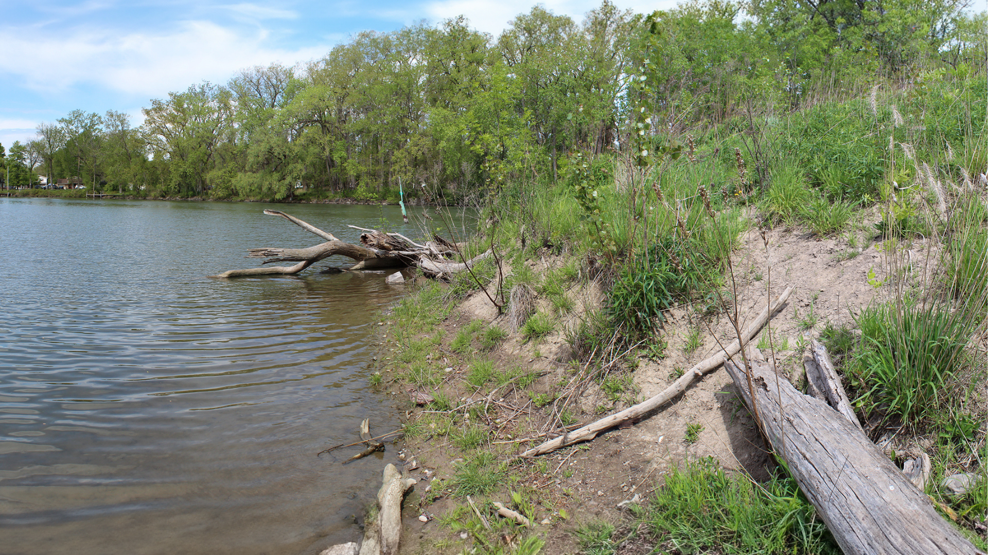
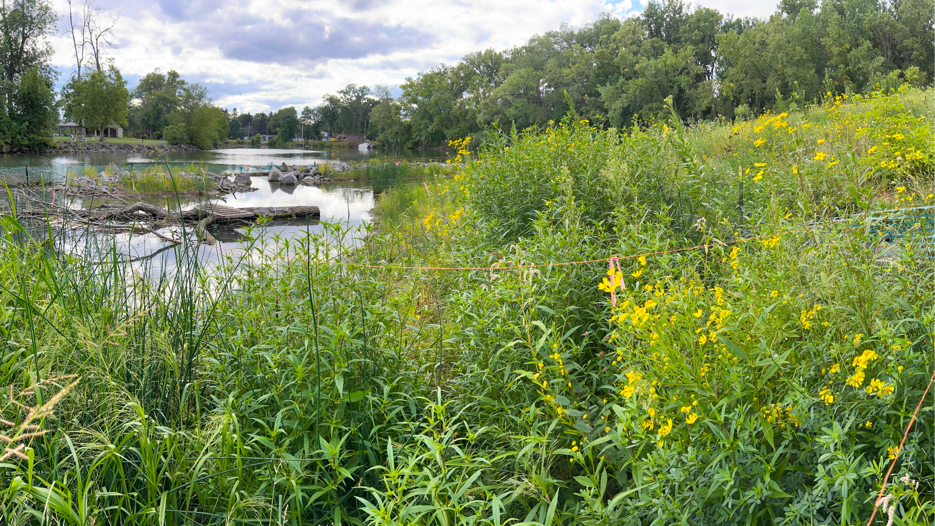
The before-and-after images demonstrate the substantial transformation of the shoreline margin and shallow emergent zones. Newly graded, gently sloping transitions across the land–water interface now provide ample space for dynamic native plant communities to self-organize in response to seasonal water-level fluctuations.


These before-and-after images highlight another significant transformation. The barrier rock reef reduces wave energy, protecting the restored shoreline, and creating calm, shallow-water conditions where shoreline margin and emergent aquatic plants can successfully establish.