
Improving access to unique waterfront features and recreational opportunities at this culturally and historically significant site.
The Stella Niagara Shoreline Enhancement Project includes expansion of the paddle-craft landing area and shoreline buffer zone at the Stella Niagara Preserve in Lewiston, NY. Pairing ecological expansion strategies with structural improvements aims to create valuable habitat for numerous fish and wildlife species, protect the shoreline from erosive forces of the Niagara River and improve water quality through runoff absorption and filtration.
Partners
OATH COMMUNITY BENEFIT FUND FOR NIAGARA COUNTY
Funder
WESTERN NEW YORK LAND CONSERVANCY
Landowner & Collaborator
LDC CONSTRUCTION
Contractor & Collaborator
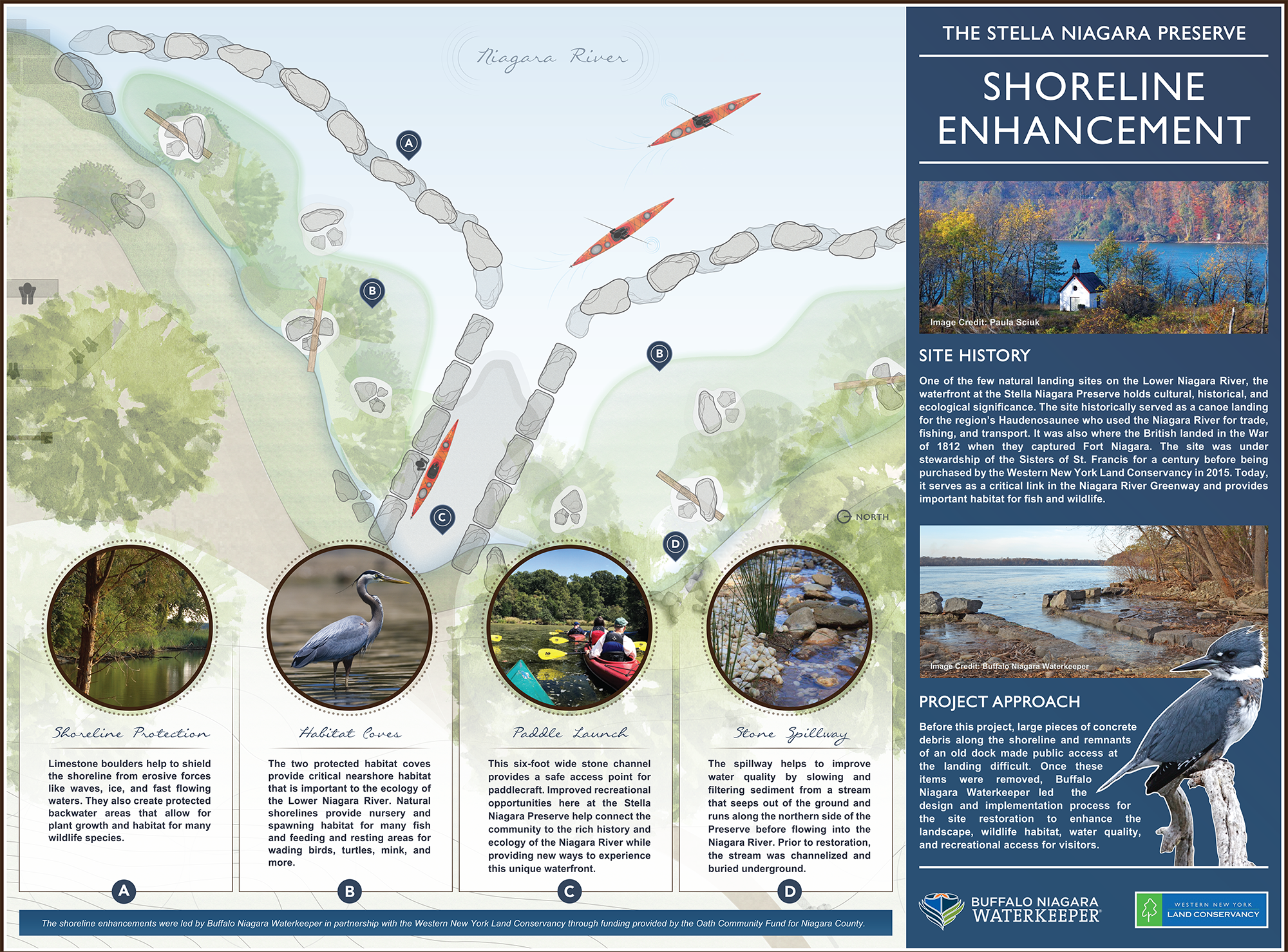
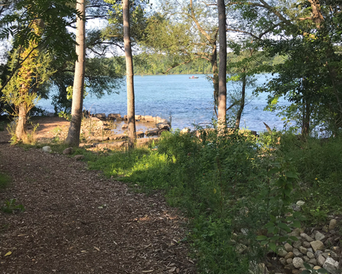
The Place
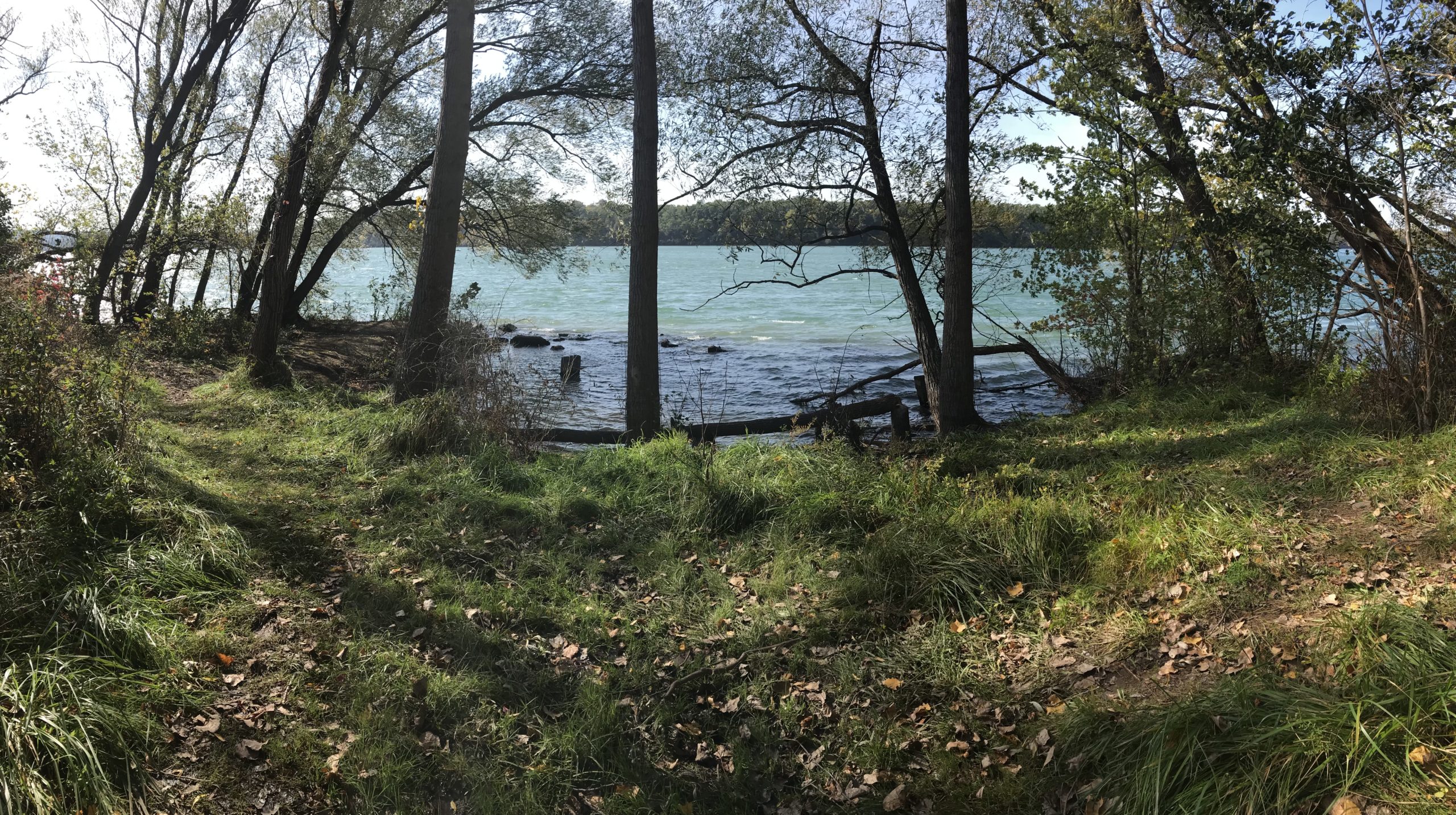
The Stella Niagara Preserve is a 29-acre parcel located along the lower Niagara River in the Town of Lewiston.
The property, acquired by the Western New York Land Conservancy in 2015, is the largest privately-owned, publicly accessible, undeveloped tract of land along the entire Niagara River, and serves as an anchor in establishing the Niagara River Greenway. The shoreline improvements completed through this project complement the restoration completed by the Land Conservancy throughout the Preserve.
This project is complete!
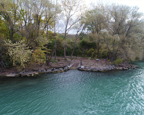
Check out this aerial footage from Eagle Hawk.
“One of the few natural landing sites on the Lower Niagara, perfect for launching a canoe or kayak. The off-shore area, known locally as the ‘Stella Drift,’ creates ideal conditions for fishing. The view from Lower River Road overlooking the property and the Niagara River is breathtaking. Considering these factors, the site is ideal for public access.”
– Western New York Land Conservancy
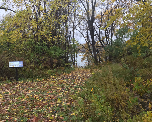
The Project
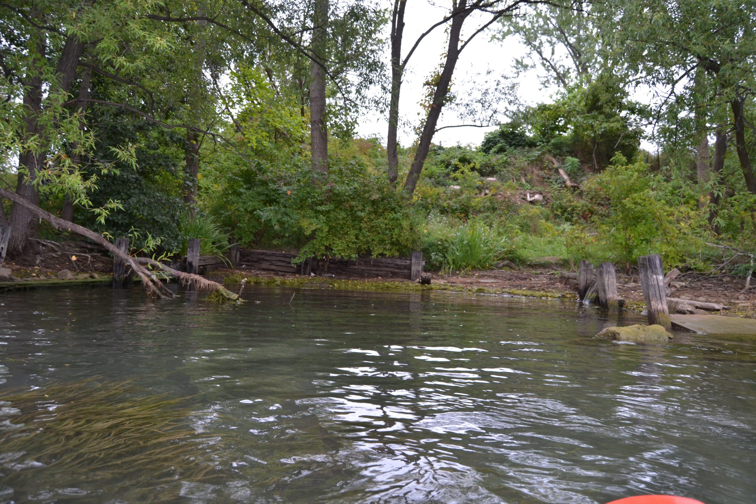
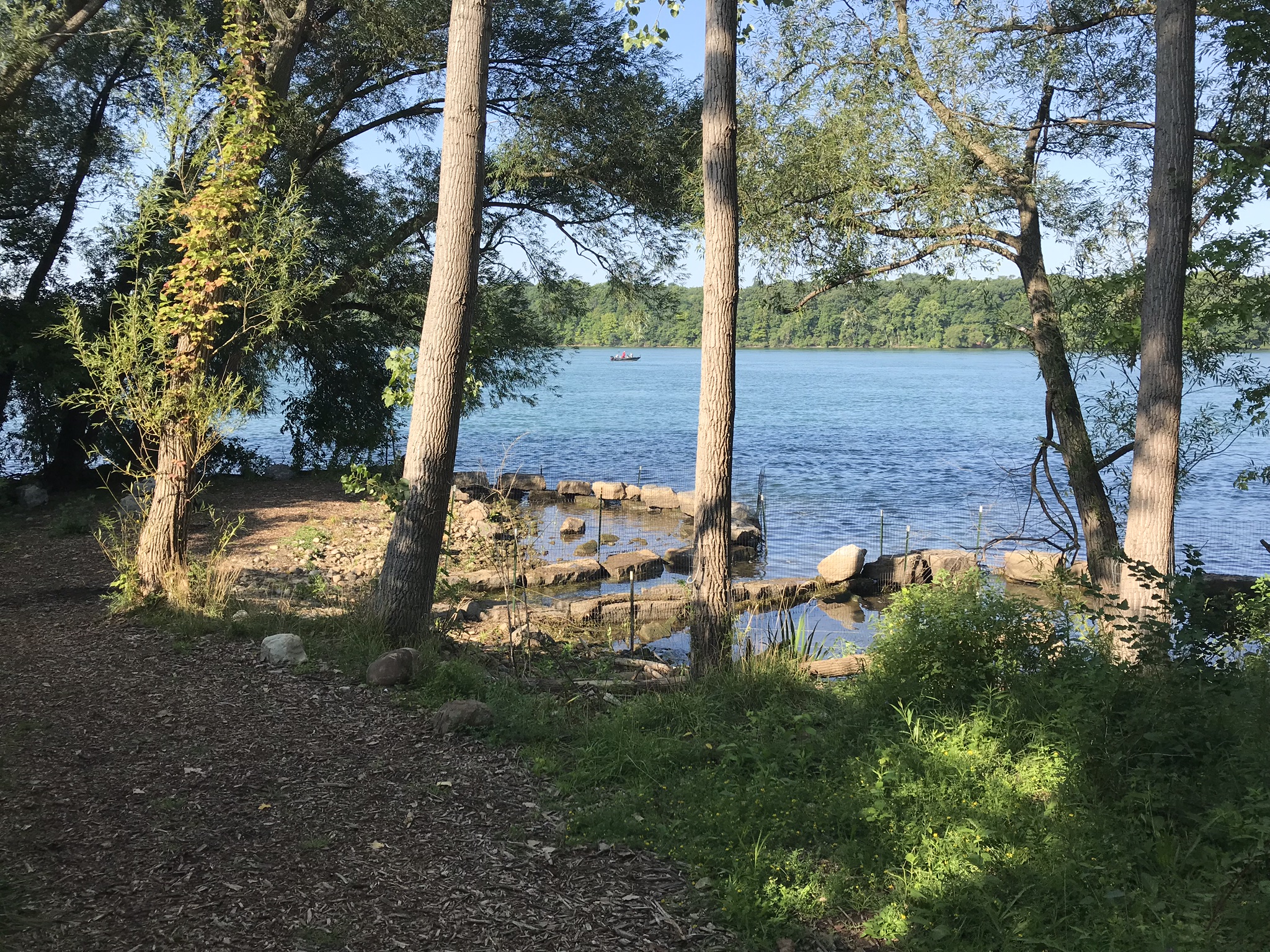
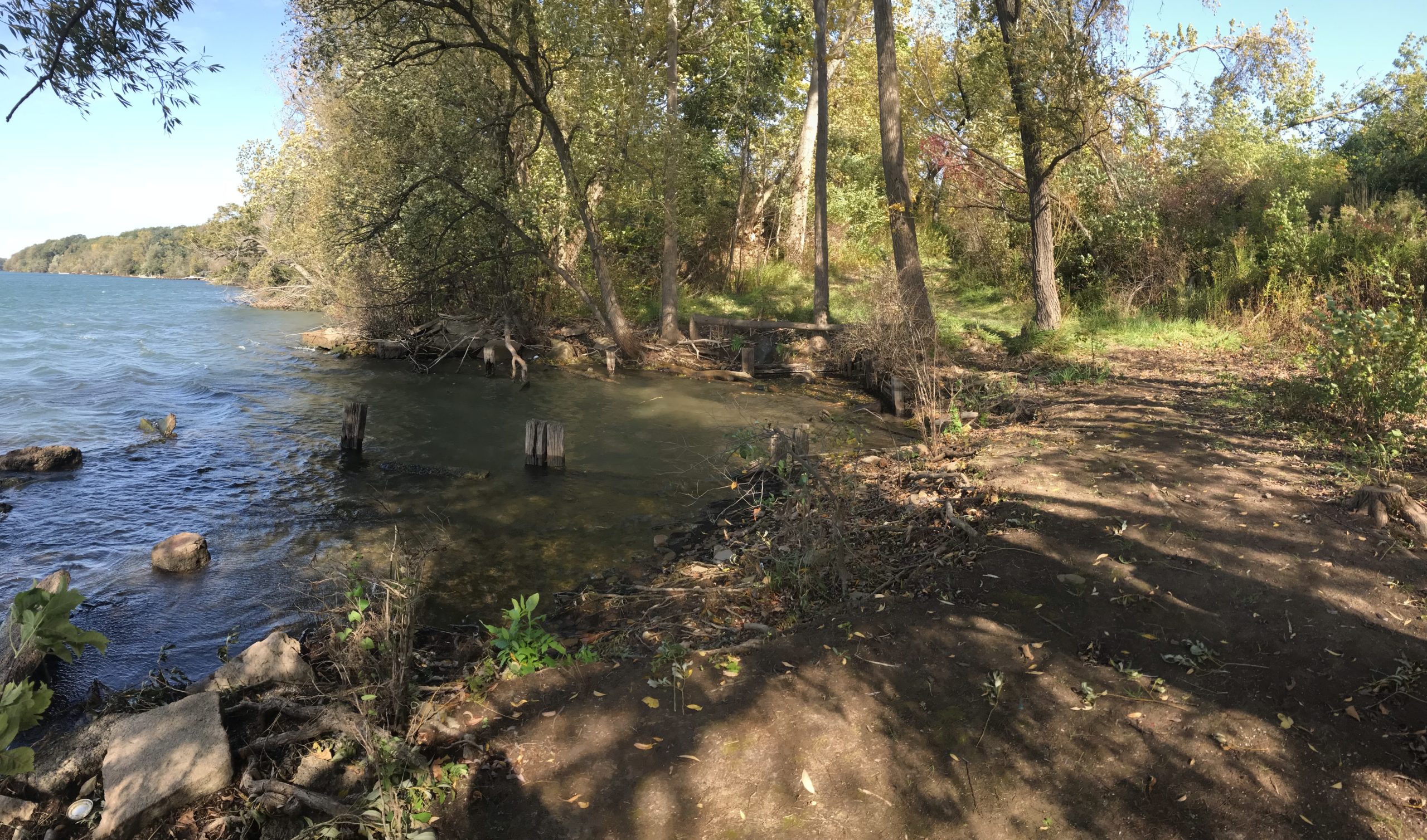
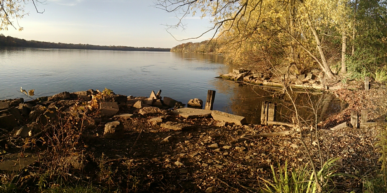
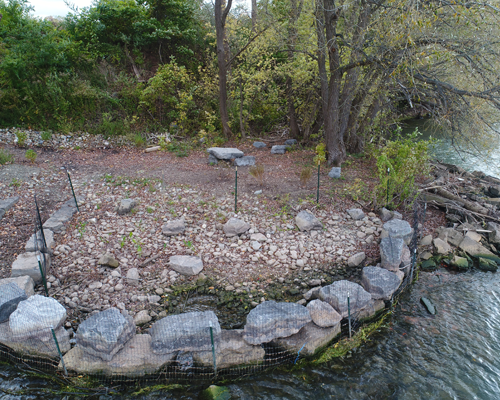
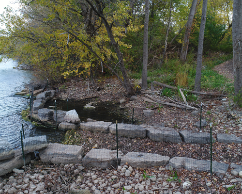
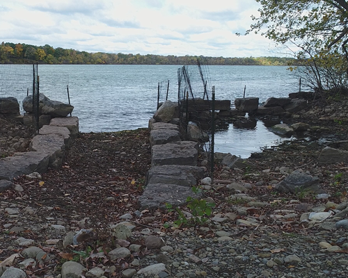
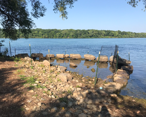
Prior to construction, conditions at the landing were not ideal for habitat or public access.
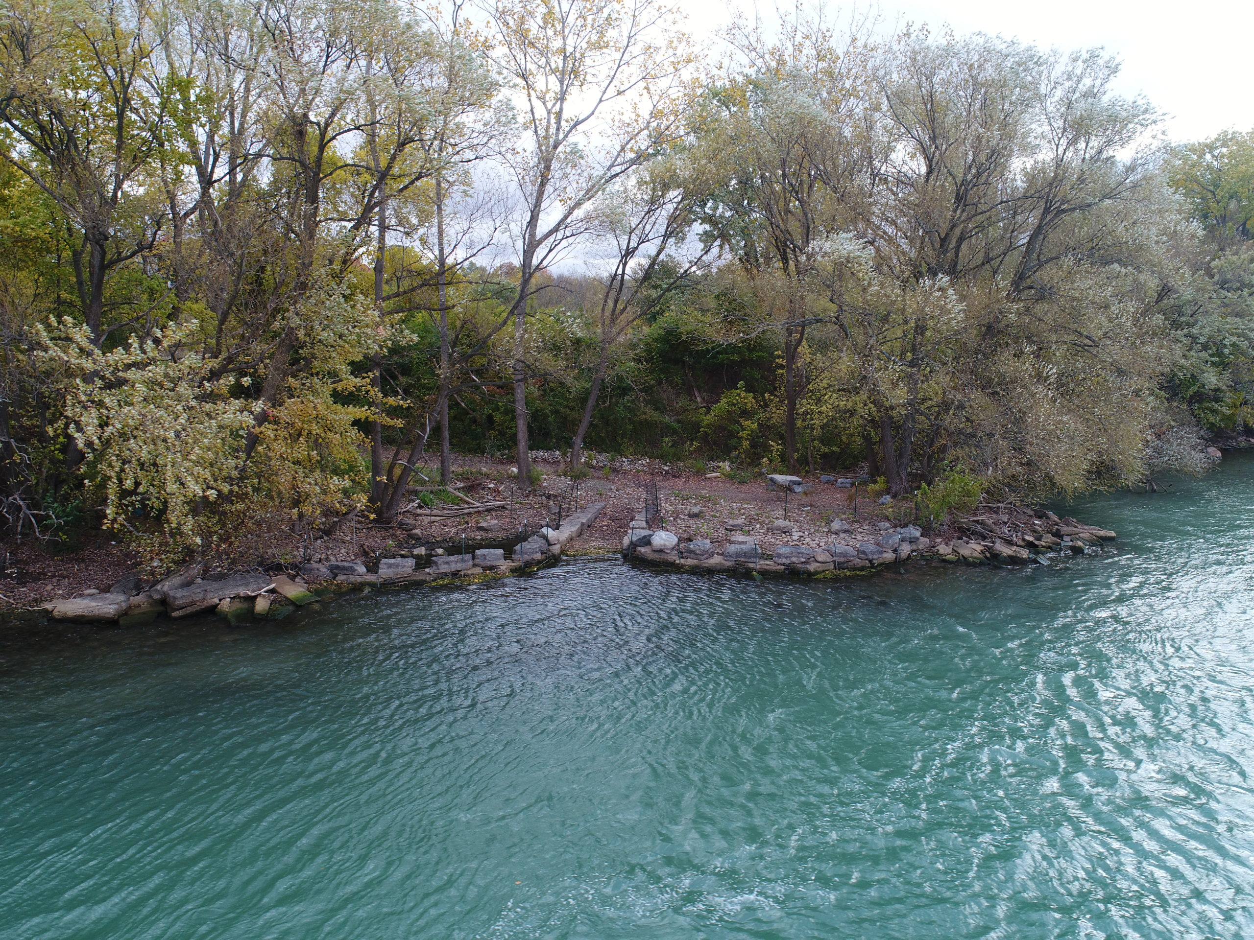
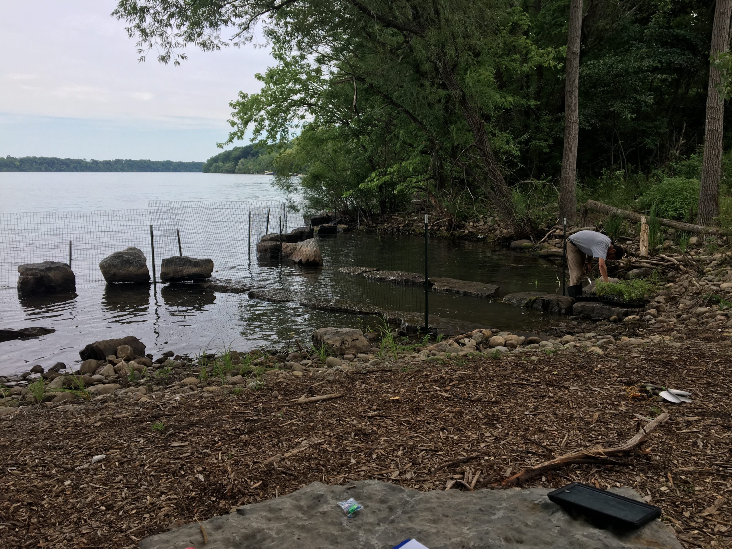
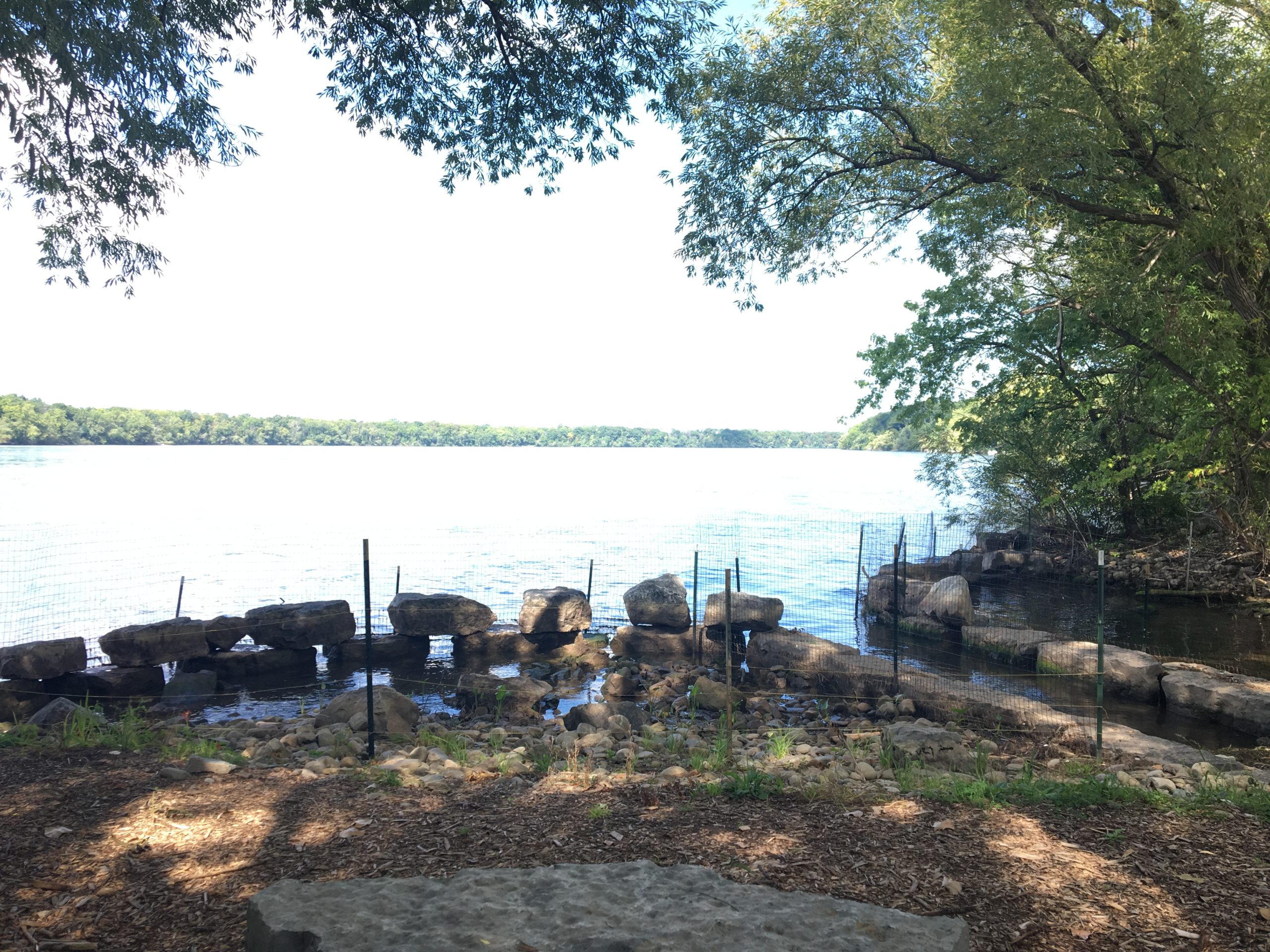
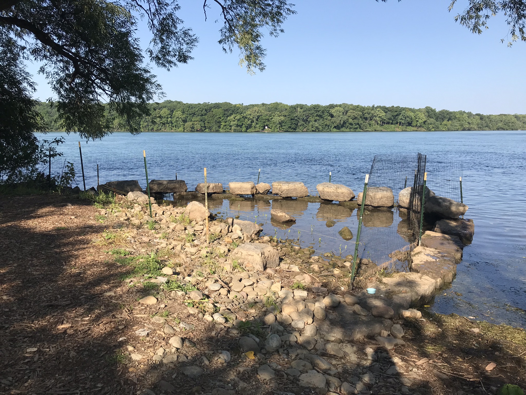
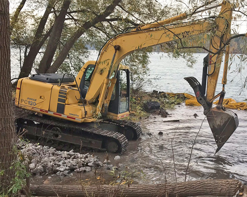
Large pieces of concrete debris dominated the shoreline. Construction activities include the removal of concrete and strategic placement of natural materials—boulders, logs, and native plants—resulting in conditions favorable for wildlife and recreational activities. Restored conditions are intended to improve accessibility for non-motorized watercraft and establish protected shallow water areas critical for resting, spawning, and nursery habitat required by many fish species in the Lower Niagara River.
Other elements of the project include a seating area and educational signage, providing enhanced opportunities to learn about the significance of the landing and enjoy the waterfront. With the structural phase of the expansion project completed in Fall 2017, the following year will bring installation of native vegetation to visually soften the shoreline and strengthen its resilience. Enhancing the quantity and diversity of upland and aquatic species will help to stabilize the soil, filter and absorb runoff, mitigate flooding, and create additional habitat for fish, birds and other terrestrial species. Additional details on the project can be found in the conceptual proposal and educational sign below.
Project Timeline
Structural Improvements
2017
Habitat Improvements
2018
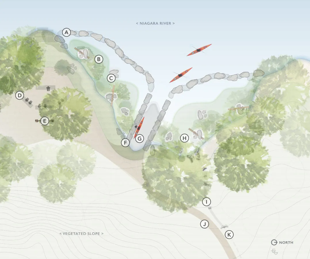
Conceptual Proposal
A. Ledgerock Breakwall
Buffers the shoreline, aquatic vegetation, and substrates from the erosive wave action and ice scour of the Niagara River.
B. Protected Habitat Cove
In-water vegetation supports wildlife, helps reduce erosion, and filters runoff before entering waterways.
C. Boulder Piles
Provides calm pockets of water where plants can establish.
D. Seating Rocks
E. Interpretive Signing
F. Ledge Rock Paddle Channel
Channel access for non-motorized watercraft to launch or land.
G. Substrate Launch Ramp
Graded for landing during both low and high water levels.
H. Protected Habitat Cove
I. Culvert Outlet Into Dry Creek
Defined creek channel and cascade pools helps reduce flooding on adjacent pathway.
J. Pathway
K. Existing Culvert