
New York State is a Great Lakes State! This is a fact many forget, as New York also has a coastline along the Atlantic Ocean. We are so lucky to have so much freshwater on our doorstep here in Western New York. Water is life.
Even with this abundance of water, many communities have become disconnected from our water resources. This may stem from physical barriers, a lack of access or missed outdoor experiences in early childhood. Rekindling these connections to our waterways is folded into our mission, and a key component to our educational programming. So let’s take a dive into a water concept that causes much bewilderment: the watershed.
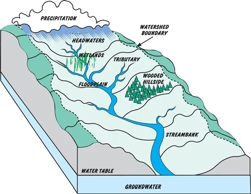
1. What’s a watershed? A watershed is an area of land that drains into a river, lake or other bodies of water. Think of it as a bathtub. If water flows into the bathtub, it will travel towards the drain. If water escapes the bathtub, the water will flow elsewhere. The bathtub is your watershed, and the drain is a receiving waterway.

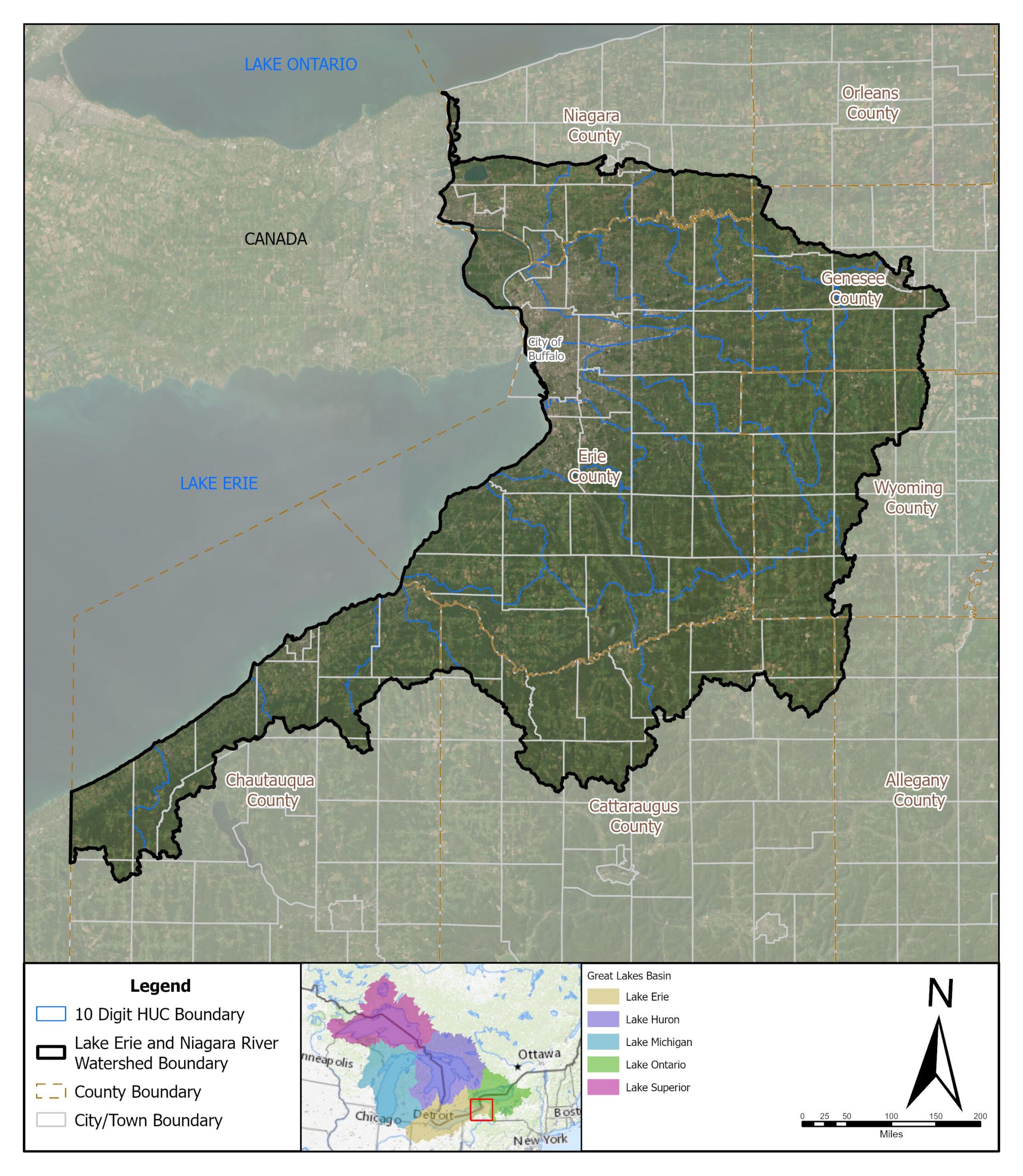
2. Why is it shaped that way? In reality, watersheds do not take the shape of a bathtub. The boundaries of a watershed are based on topographical features, like hills or the geology of the soil. These features control which way water will flow. In the Niagara River Watershed, the rolling hills of the Allegheny Plateau create the southern watershed border. The geography of the land changes as you travel toward the northern sections of the watershed. Here you will find flat low-lying areas. A prominent feature in the Niagara River Watershed is the Niagara Escapement. Learn more about this geologic feature.
3. Why should I care and learn about my local watershed? Water plays an essential role in our lives; it’s connected to everything in our world. Water is used for drinking, cooking, agricultural irrigation, industrial processes, bathing, shipping, fishing, and aquaculture, plus our recreational enjoyment. It’s essential to our lives, lifestyles and economy. In Western New York, the source of most residents’ drinking water is the Great Lakes and the Niagara River. In rural areas, well water is also a source.
Understanding how various activities throughout the watershed impact water quality is so important to protecting our water resources. When it rains, or snows, water may be absorbed into the ground or it will flow over the land’s surface heading for a low point. In Western New York, most of this surface runoff flows into lakes and streams (and also storm drains, which in some circumstances overflows into our water bodies). This surface water runoff will carry sediment, nutrients and other contaminants with it. Many of our projects help to filter runoff before it gets to our creeks and rivers, including our cleanups, native plantings, and Living Shorelines.
4. What more do I need to know about the watershed? Here are a few other tidbits about the Niagara River Watershed.
• It’s located along the westernmost portion of New York State and encompasses lands that drain into the Niagara River, a channel that connects the Great Lakes of Erie and Ontario.
• It’s part of the larger Great Lakes Drainage Basin.
• It encompasses 903,305 acres of land, 71 municipalities, 3,193 miles of watercourses, and 52,979 acres of state and federally listed wetlands.
Buffalo Niagara Waterkeeper works to protect and restore waterways throughout the watershed, including the lesser-known headwater region. Headwater streams are small tributaries (first-third order streams) in the upper reaches of a watershed. The protection and preservation of lands surrounding these streams are crucial for the protection of water quality in our bigger waterways, as well.
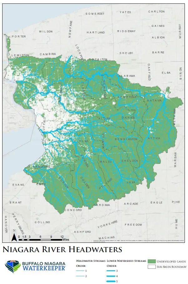
Click below to view a map of the Niagara River Watershed and see the headwaters and undeveloped lands.