
An overview of Buffalo Niagara Waterkeeper’s water quality sampling, restoration, and cleanup efforts.
Introduction
This report is an educational tool providing information about water quality in the Western New York Region. Buffalo Niagara Waterkeeper (Waterkeeper) works to improve water quality through volunteer citizen science and cleanup programs, water quality monitoring, restoration projects throughout Western New York, and educational outreach.
Included in this report is information about how the New York State Department of Environmental Conservation (DEC) creates water quality standards and stream designations, water quality issues in streams sampled, baseline water quality data, information regarding Harmful Algal Blooms (HABs), bacterial sampling results, PFAS sampling efforts, restoration project highlights, and much more!
Image of the Niagara River by Ryan Sajdak
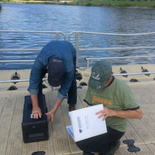
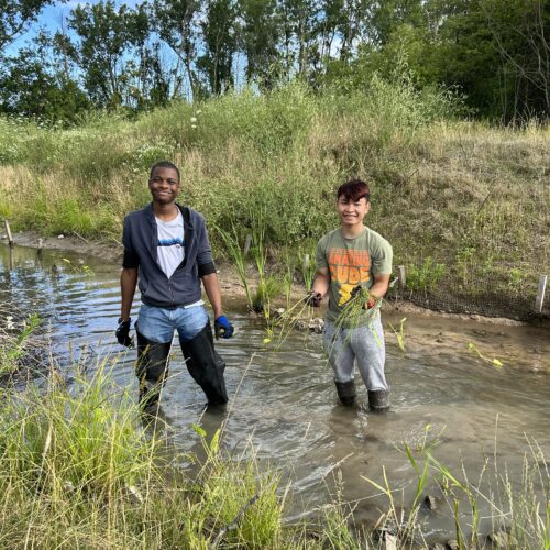
Water testing at Ellicott Creek at Niagara Falls Boulevard.
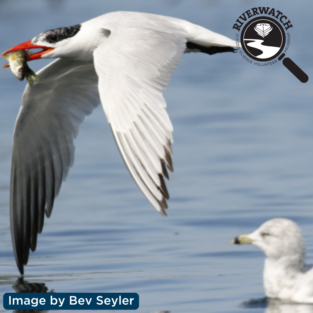
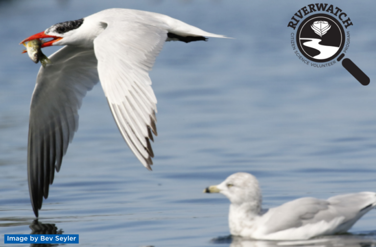
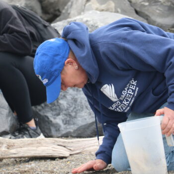
Riverwatch is a volunteer citizen science program. Waterkeeper staff train concerned community members to gather important water quality data in the Niagara River Watershed. These volunteers provide a network of ‘eyes on the water’ and help provide surveillance monitoring to bolster regional baseline water quality data. Waterkeeper recognizes the many barriers for full community participation in environmental volunteer programs and is continually working to reduce these barriers in our programming, including within Riverwatch.

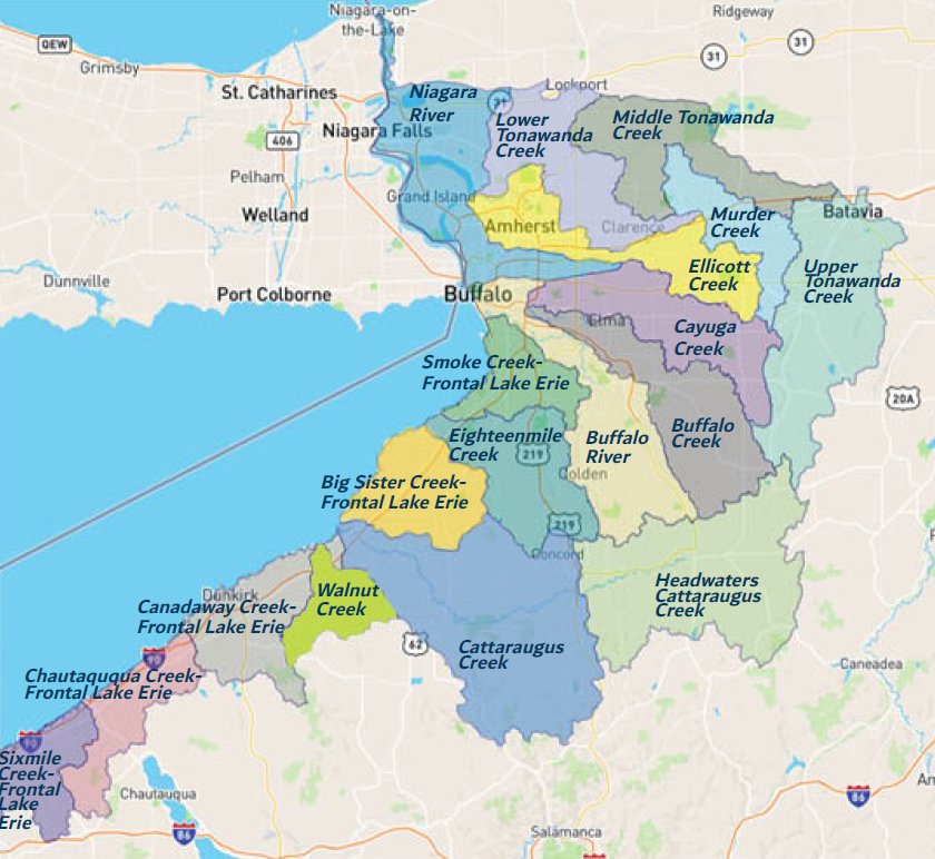
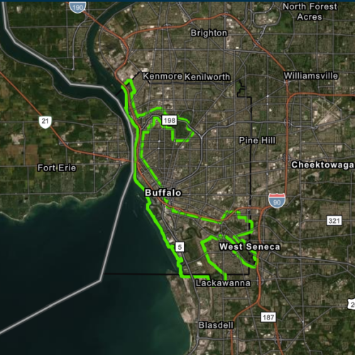
Niagara River/Lake Erie Watershed
The Niagara River/Lake Erie Watershed is located along the western most portion of New York State and encompasses lands that drain into Lake Erie and the Niagara River, a channel that connects the Great Lakes of Erie and Ontario. The Niagara River/Lake Erie Watershed is one of 17 major watersheds in New York State and also part of the larger Great Lakes Basin. The Great Lakes Basin holds 21% of the world’s freshwater resources.
The Niagara River/Lake Erie Watershed, which can be divided up into 19 smaller sub-watersheds, encompasses over 1.5 million acres of land or over 2,300 square miles. Within this area of land, there are over 4,000 miles of rivers and streams. This watershed includes 92 miles of Lake Erie shoreline.
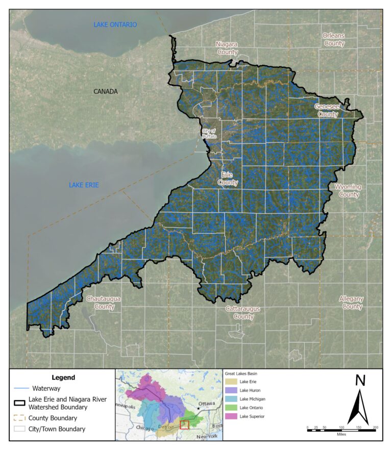
Map 1: Niagara River/Lake Erie Watershed
To learn more about the Niagara River/Lake Erie Watershed and watershed planning visit:
www3.erie.gov/environment/watershed-management-plan
New York State Waterways
CLEAN WATER ACT AND WATER QUALITY STANDARDS
The Clean Water Act (CWA) establishes the basic structure for regulating discharges of pollutants into the waters of the United States and regulating quality standards for surface waters. Water Quality Standards are created by the DEC with oversight from the United States Environmental Protection Agency. These standards are set by first determining best usages and establishing water quality criteria. Water quality criteria are numeric and narrative descriptions of the conditions in a waterway necessary to support Best Uses.
If all water standards are met, antidegradation policies and implementation methods are employed to keep the water quality at acceptable levels. If the waterway is not meeting water standards, a strategy to reduce pollutants and meet these standards is needed. Strategies are authorized by the CWA, utilizing available tools from federal, state, and local governments and nongovernmental organizations.
The DEC Division of Water staff oversee water quality and flood control programs throughout the state. Utilizing a number of programs, they are able to track the quality of water, identify sources of pollution, and work to control sources of pollution.
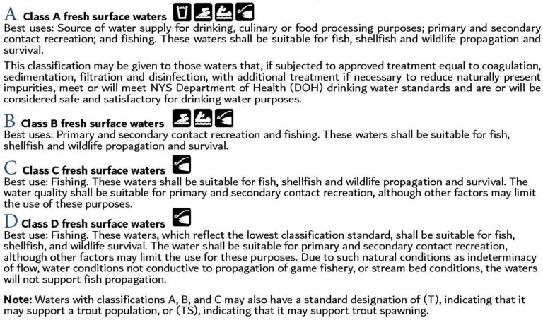
BEST USES AND STREAM CLASS
All waterways in the state are assigned a letter classification and standard designation by the DEC, which is based on the waterway’s existing or expected Best Uses. Best Uses include: source of drinking water, swimming, boating, fishing, and shell fishing. There are subcategories under water-based recreation to refer to the proportion of time in which someone engaging in certain types of activities would come into direct contact with the water. Secondary contact refers to short-term contact, which may include jet skiing or canoeing. Primary contact refers to long-term or whole body contact and may include swimming, kayaking or snorkeling.
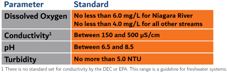
Baseline Water Chemistry Sampling Parameters & Standards
Riverwatch Baseline Water Chemistry Volunteers collect data on the following parameters using a Eureka Manta+ 20 meter and a HACH 2100Q Portable Turbidimeter.
This report summarizes water chemistry data collected and compares it to set standards. These standards are established by the DEC with oversight from the EPA.
Standards are as follows:
Temperature
The temperature of water governs what aquatic life will inhabit a waterway. Additionally, temperature controls the dissolved oxygen content of water (as the temperature of water increases, the concentration of dissolved oxygen content decreases), and influences the rate of chemical and biological reactions. Water temperature can be impacted by sunlight duration and intensity, and discharges entering the waterbody.
Dissolved Oxygen
Dissolved oxygen enters water from the atmosphere, from aeration as it tumbles over rocks and falls, and from photosynthesis. Dissolved oxygen is essential for the survival of nearly all aquatic life and levels can decrease with the introduction of various pollutants including sewage discharges, stormwater runoff, and failing septic systems.
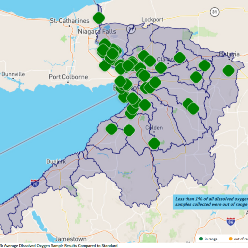
Click to view a larger image.
Conductivity
Conductivity is a measure of water’s capability to pass an electrical current and indicates the presence of inorganic dissolved solids such as salts, chlorides, nitrate, sulfate, and phosphate ions. Conductivity is affected by the geology of the area through which the water flows. Elevated levels may indicate the presence of sewage or stormwater discharges and runoff. Streams outside of the standard range may not support healthy fisheries and other aquatic life.

Click to view a larger image.
Total Dissolved Solids
Total Dissolved Solids is a measure of inorganic and organic substances dissolved in water which include salts and minerals. Salts from roadways may run off into waterways resulting in an elevated Total Dissolved Solids reading.
pH
pH is a measurement of the potential activity of hydrogen ions (H+) in a sample. The pH reading of a water sample indicates its acidity on a scale from 0 to 14 with 7 being a neutral value. Solutions with a pH less than 7 are considered acidic and solutions above 7 are considered basic. The pH of water determines the solubility and biological availability of chemical constituents such as nutrients. The majority of aquatic animals prefer a range of 6.5 to 8.5. A pH outside this range stresses the systems of most organisms and can reduce reproduction, thereby reducing the diversity in the waterway. Pollution sources can alter the waterway’s pH.
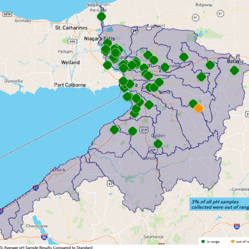
Click to view a larger image.
Turbidity
Turbidity is a measure of the clarity of a liquid. Suspended solids including soil particles, algae, plankton, and microbes impact turbidity. Erosion of sediment and stormwater runoff will increase the turbidity of waterways. High turbidity increases water temperatures, decreases Dissolved Oxygen, provides refuge for harmful microbes, and can clog the gills of fish and crustaceans.
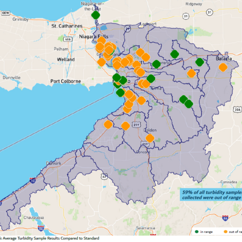
Click to view a larger image.
About The Waterbodies Sampled
The following waterbodies are sampled by Riverwatch volunteers and Waterkeeper Staff. The water quality issues listed here reference the DEC’s Waterbody Inventory/Priority Waterbodies List. The stream length often includes waterbody tributaries.
Click on a plus sign on the image to view each waterbody sampled. Note, marks are not to scale.
Explore these waterways using the DEC info Locator at www.dec.ny.gov/maps/interactive-maps/decinfo-locator
WNY WATERWAYS AND OUR CHANGING CLIMATE
Regional Changes
The Earth’s climate is changing as a result of our exponential increase in the burning of fossil fuels that we use to power our transportation systems, global energy production, and unprecedented growth of plastic manufacturing.
Our region is already experiencing the effects of climate change and collectively we are experiencing significant differences in weather patterns over longer periods of time. The impacts of climate change vary across the world, and we are experiencing our own version of it locally. These changes include increased air temperatures, increased surface water temperatures, more heavy precipitation, and changing winter precipitation.
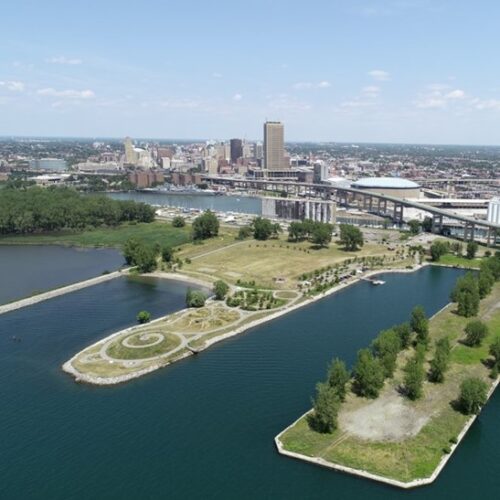
Buffalo’s Outer Harbor
Coastal Resiliency Study Project Area
These conditions lead to increased stormwater runoff, which result in erosion, flooding, and more sewage overflow into our lakes and rivers. Toxic algae blooms are on the rise, due in part to excessive run-off of nutrient-rich stormwater, and ecosystems and habitats may be permanently altered. Our region has also been experiencing increased infrastructure failure. New York State is responding to the Climate Crisis with a series of legislative actions such as the Climate Leadership and Community Protection Act, and the Environmental Bond Act to name a few.
Waterkeeper has been working with local government and community partners to build resiliency to the impacts of climate change, like flooding and erosion, within the WNY and Great Lakes regions. As guardians of New York’s freshwater coast, Waterkeeper works to identify opportunities to enhance community resilience through policy, partnerships, and nature-based solutions.
One effort is the ongoing Buffalo Coastal Resiliency Study. It is an assessment of flood risks along the Lake Erie coastline. The project area includes the City of Buffalo waterfront and the lower reaches of the Buffalo River and Scajaquada Creek.
Learn more about the Buffalo Coastal Resiliency Study at bnwaterkeeper.org/climate-resiliency/
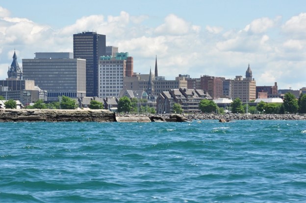
City of Buffalo Coastline
Buffalo River Progress
Area of Concern
The Buffalo River was designated a Great Lakes Area of Concern (AOC) in 1987 by the US and Canada under the Great Lakes Water Quality Agreement. AOCs are locations that experienced environmental degradation and no longer provided ecological and human services as desired. In total, 43 AOCs were established, with 26 in the U.S., 12 in Canada, and 5 binational. Two years after its designation, a community of volunteers formed the Friends of the Buffalo River, now Buffalo Niagara Waterkeeper, to address the challenges of a waterway that had been declared dead for 20 years.
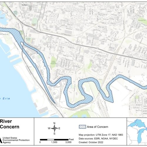
Buffalo River Area Of Concern (AOC)
Waterkeeper, along with its many partners, has worked tirelessly for over three decades to bring the Buffalo River back to life. In 2005, Waterkeeper became the first private non-profit to be an AOC Remedial Action Plan (RAP) Coordinator. Since Waterkeeper became the Buffalo River AOC RAP coordinator, five of the nine Beneficial Use Impairments (BUIs) have been removed, including three in one year: Restrictions on Dredging Activities (September 2022), Loss of Fish and Wildlife Habitat (July 2023), and Degradation of Benthos (September 2023).
A BUI is a common use or feature of a waterway that has been negatively impacted by environmental degradation. RAP coordinators work to coordinate projects that will improve the environmental health of the waterway, so that these designated impairments can be removed. Once all the BUIs have been removed, the waterway is de-listed from the AOC list.
Multiple restoration activities have led to the successful removal of Buffalo’s BUIs. Through funding from the Great Lakes Legacy Act, remedial dredging was completed in 2015 with over 1 million cubic yards of highly contaminated sediment from the AOC was removed. Habiat Restoration was implemented at 5 aquatic areas – covering 7 acres – and included porcupine cribs, root-wad logs, gravel spawning beds and 77,000 emergent and submerged plants. The Habitat Action Plan, funded by the Great Lakes Legacy Act and Great Lakes Restoration Initiative, resulted in 30,000 linear feet of shoreline restored to native riparian habitat, exceeding the goal (25% of AOC shoreline restoration) for removing the Loss of Fish and Wildlife Habitat BUI..
Toxicity sampling was also conducted as part of the post remedial monitoring and demonstrated that the sediments did not have negative impact to benthic organisms, allowing the removal of the Degradation of Benthos BUI. The Buffalo River RAP coordinators and Remedial Action Committee continue to work towards the removal of the four remaining BUIs:
1) Fish Tumors and Other Deformities
2) Fish Consumption
3) Bird and Animal Deformities or Reproductive Problems
4) Degradation of Fish and Wildlife Populations
Community members are encouraged to join the Remedial Action Committee to assist in the BUI removal process. Waterkeeper is looking for anglers, birders, naturalists, boaters, tour leaders, and Buffalo River corridor residents to take part! You may contact Rob Coady at rcoady@bnwaterkeeper.org or 716-852-7483, ext. 19 to learn more.
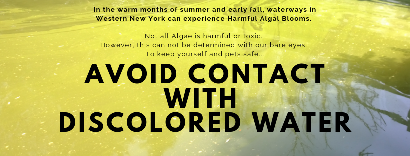
Harmful Algal Blooms (HABs)
Harmful Algal Blooms (HABs) are excessive population growths of algae that cause harm to human health, ecosystems, or the economy. Most algae are harmless and are components of a healthy aquatic ecosystem. The algae of highest concern in Western New York are cyanobacteria, Cladophora sp., and euglenoids. Cyanobacteria blooms can produce toxins that have resulted in contaminated drinking water in Lake Erie and New York.
HABs are likely to occur in slow moving water with excess nutrients like nitrogen and phosphorus. Warm temperatures and abundant sunlight also create ideal conditions for blooms. HABs are more likely to occur with our changing global climate.
HABs are harmful to people and animals. Exposure to toxins produced by cyanobacteria include stomach, skin, eye, and throat irritation, allergic reactions or breathing difficulties. If you think you are experiencing health risks associated with a HAB, consider visiting a healthcare professional. Pets should not enter water with a suspected HAB. Dogs and livestock that swim or drink water that contains microsystin and other cyanotoxins can become severely ill or die. Even after visible blooms subside, the toxins may still be present in the water.
Cyanobacteria Blooms have become prevalent in the western and central basin of Lake Erie in recent years. During 2023, there were several HABs reported at and near Presque Isle State Park, located along the Lake Erie coast in Pennsylvania. During the swimming season, the Regional Science Consortium posts HABs updates to their webpage: regsciconsort.com/harmful-algal-blooms/local-hab-advisories/
For additional information, including forecast models visit: glerl.noaa.gov/res/HABs_and_Hypoxia/
Report a HAB
To report a potential bloom to DEC, fill out and submit a Suspicious Algal Bloom Report Form. Visit their webpage: dec.ny.gov/chemical/77118.html
You can also notify Waterkeeper by submitting a report, using the QR code below or by emailing a photo and location information to Rob Coady at rcoady@bnwaterkeeper.org
For additional information visit: bnwaterkeeper.org/harmful-algal-bloom/
Blooms in the Niagara River/Lake Erie Watershed
Waterkeeper staff respond to HAB reports made by Riverwatch volunteers and community members throughout the year. A water sample may be collected by trained staff if deemed necessary and identified using a microscope. Sample results are then forwarded to the DEC.
-HABs are dangerous and should not be touched without proper training and protective equipment.-
Waterways in our watershed can experience different types of HABs. Some waterways are prone to Cyanobacteria blooms while others are prone to Euglena blooms. Euglena are single-celled flagellated microorganisms that feature both plant and animal characteristics. Some species of Euglena are known to produce ichthyotoxins. To the bare eye, Euglena blooms and cyanobacteria blooms look very similar. The difference is evident when looking at a sample under a microscope.
The following w waterbodies in the Niagara River Watershed were documented with blooms in 2023. This list includes both cyanobacteria blooms and Euglena blooms. Blooms are recorded by the DEC and can be viewed here.
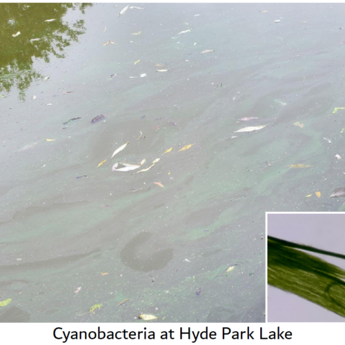
Once again, this man-made lake that is created by damming Gill Creek experienced a cyanobacteria bloom from July to October. Microcystin was detected at low levels multiple times in water samples collected by Waterkeeper and analyzed by the Erie County Department of Health Public Health Laboratories.
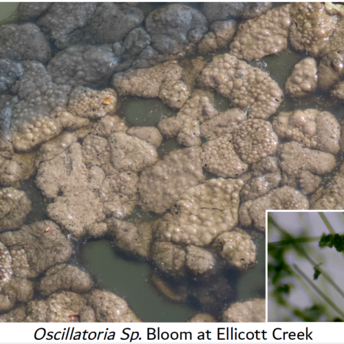
For several years, this waterway has experienced frequent and persistent Euglena blooms throughout the summer and fall. This year Waterkeeper was awarded funding from the Lake Erie Watershed Protection Alliance to form the Ellicott Creek Euglena Technical Advisory Committee (TAC) with the goal to make recommendations on how to address this ongoing problem. The first TAC meeting was held in the Fall of 2023 with representatives from federal, state, and local government and local university researchers present. BNW also observed a bloom of Osccilatoria sp. in Ellicott Creek. This type of bloom forms floating mats, showing how varied cyanobacteria blooms can truly be.
This waterway also experiences frequent Oscillatoria sp. and Euglena sp, blooms from Ransom Creek to the mouth of the Niagara River from May through September.
A type of cyanobacteria, Oscillatoria sp. , was observed near the mouth of this creek in May and September.
Oscillatoria sp. was observed in this creek, near Woodlawn Beach, in May.
Oscillatoria sp. was observed within the confines of the Harbor Place Marina in June.
Bacteria Sampling
Bacteria Basics Bacteria are single-celled organisms naturally found in the environment. Some bacteria are harmless to humans and can actually help aid natural processes. Escherichia coli (E. coli) is a bacterium found in the environment, foods, and intestines of people and animals. Many strains of E. coli are harmless to humans. However, some strains can result in serious health problems and sickness. E. coli is a strong indicator of sewage pollution or animal waste contamination when found in local waterways.
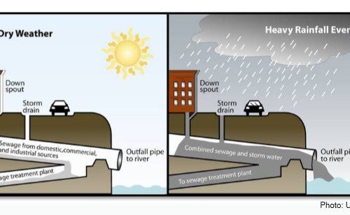
Most older cities and municipalities in New York State, including the cities of Buffalo and Niagara Falls, have combined sewer systems. In contrast, most outlying suburban areas utilize separate storm and sanitary sewers.
During rain events in a combined sewer system, water from streets, roofs, and lawns flows into storm drains and combines with sewage in one system. When there is heavy rainfall, the volume of water overwhelms the system and overflows into local waterways by design. These overflows are referred to as Combined Sewer Overflows (CSOs). These overflows contain not only stormwater, but untreated human waste, toxins, and debris. When improperly maintained, septic systems also have the potential to discharge bacteria and pathogens into area waters.
Waterkeeper staff sampled 10 sites during 2023 between the months of May and October for E. coli bacteria. Locations were selected based on the presence of combined sewer outfall pipes nearby or the presence of a kayak launch. Some sites were not sampled each month due to access issues or weather related events. Samples were analyzed using the R-CARD® Rapid Test Method. Samples were collected during a dry weather period and a wet weather period. Some months only allowed for the collection of samples during either dry weather or wet weather.
• Dry Weather Period: A water sample can be collected at the sample site if there has been no rain in the past 3 days.
• Wet Weather Period: A water sample can be collected at the sample site during a rain event or immediately after a rain event. A qualifying rain event is 5 hours of rain OR half an inch of rain at the sample site.
Sampling results were compared to the EPA’s Beach Action Value (BAV) of 235 cfu/100mL. This value is often used for making beach notification decisions (i.e., closures or advisories). As seen in Figure 2 on the following page, higher levels of E. coli were recorded during wet weather periods versus dry weather periods. It continues to be very common for sampling sites to exceed the BAV after wet weather events.
Caution should be made when recreating in local waterways during, or soon after, wet weather periods. Waterkeeper will continue to conduct bacteria sampling of local waterways to better inform community members of waterway conditions and to track down pollution sources.
These results were uploaded to Swim Guide, a website and app that presents free water quality information for over 8,000 possible swimming and water recreation locations in multiple countries. Explore Swim Guide today at www.theswimguide.org/ To view detailed sampling results visit bnwaterkeeper.org/our-impact/water-quality/
Click to view a larger image.
Escherichia coli results in comparison to the EPA BAV
NOTE: Due to staff and weather restrictions, no samples were collected in June and July during dry weather conditions.
PFAS Surface Water Testing
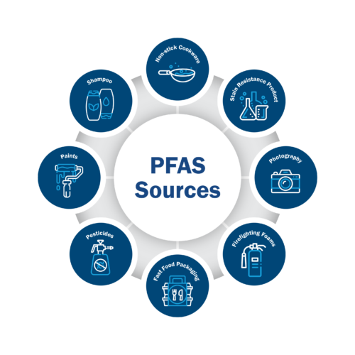
PFAS, or Per- and polyfluoroalkyl substances, are a large, diverse class of manmade chemicals. There are over 15,000 PFAS chemicals, often referred to as ‘forever’ chemicals because they do not naturally break down. Exposure to these chemicals have been linked to a variety of health effects including cancer, liver damage, decreased fertility, and others. Learn more about PFAS at bnwaterkeeper.org/pfas-pfoa-pfos/
Experts estimate that more than 200 million Americans are exposed to PFAS through drinking water. The EPA has proposed a National Primary Drinking Water Regulation to establish legally enforceable levels for six PFAS. This regulation should be finalized by the end of 2023 or early 2024. Several states have moved ahead and set their own regulations, New York being one. As of 2022, the NYS Department of Health (DOH) regulates 2 PFAS chemicals in public drinking water supplies. PFOA and PFOS drinking water standards, or Maximum Contaminant Levels (MCLs), are set to 10 parts per trillion each for public water supplies. The DOH will soon propose regulations for 23 additional PFAS chemicals. Read more about the DOH’s actions on PFAS here: www.health.ny.gov/environmental/water/drinking/emerging_pfas_publicwater.htm
Surface waters currently lack protections from PFAS chemicals. Experts estimate that nearly 30,000 facilities discharge PFAS into surface waters in the US. These discharges are currently unregulated, as the EPA has not designated any PFAS as hazardous substances under the Clean Water Act. Read more about the EPA’s actions on PFAS here: www.epa.gov/pfas/key-epa-actions-address-pfas
New York State is making progress toward regulating PFAS discharges into waterways. The DEC has created Ambient Water Quality Guidance Values for PFOS, PFOA, and 1,4-Dioxane. These guidance values are to be incorporated into State Pollutant Discharge Elimination System (SPDES) permits, which would reduce industrial facilities discharges into waterways. Read more about the DEC’s Actions here: https://dec.ny.gov/environmental protection/water/emerging-contaminants
Starting in 2022, Waterkeeper began collecting surface water samples from waterways in Western New York. To date we have collected samples from 12 different waterways throughout the watershed. To the right is a chart showcasing some of the various PFAS. For more comprehensive results visit bnwaterkeeper.org/pfas-pfoa-pfos/
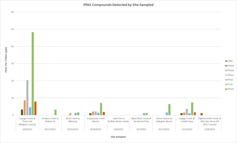
Click to view a larger image.
Some of the various PFAS compounds detected at various waterways sampled throughout 2023
Restoration Project Highlight
Starting in 2013, Waterkeeper has been transforming degraded shorelines throughout WNY utilizing innovative methods and approaches. This restoration is greatly needed as much of the shoreline habitat has been greatly altered from its natural state. These shoreline restoration projects enhance water quality, habitat integrity, and natural functions, while transforming the sites to a more resilient, self-repairing form. Characteristics of Living Shorelines include gradual natural slopes, native and naturalized plant species, and other natural materials that help to buffer the shore from storm effects and hydrologic forces. Learn more about the Living Shorelines Program here: bnwaterkeeper.org/living-shorelines/
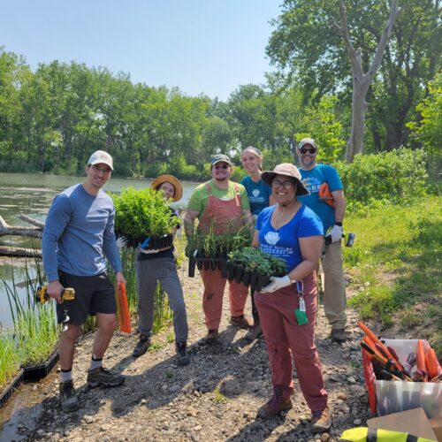
To assist with the ongoing maintenance needs of Waterkeeper’s Living Shoreline and other Habitat Restoration project sites, staff developed a new program, the RestoreCorps Restoration and Adaptive Management Program (RECO RAMP). In its pilot year, 3 volunteers joined the program as our ‘Summer Stewards’. These Stewards completed 15 service learning experiences mentored by Waterkeeper staff, gaining valuable habitat restoration and community engagement experience.
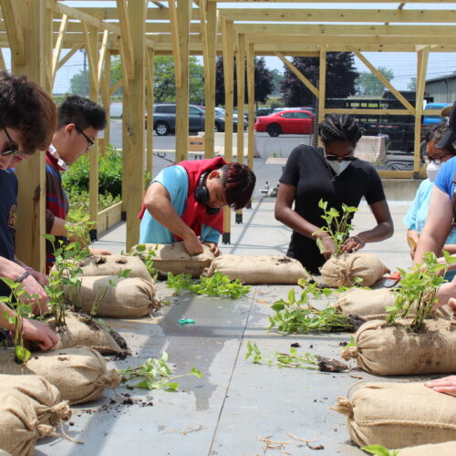
Project sites greatly benefited from the ongoing care provided by the Stewards, who planted over 4,000 plants of 50 different species, installed and cleaned bird boxes, manually removed nuisance plant species, removed litter and repaired plant protection devices. Stewards also participated in the creation of Rock socks, which were later installed in wetland habitats.
Rock socks are created by filling biodegradable burlap bags with a special planting substrate and planting them with wetland plants in a controlled nursery setting. These plants are able to establish their root system before being introduced into their final wetland habitat, providing them a better chance of survival. Rock socks were cared for by the staff at Silo City until they were ready to be utilized at numerous project sites throughout the Watershed.
Learn more about the Summer Stewards activities here:
bnwaterkeeper.org/meet-our-2023-summer-stewards
The RestoreCorps Program is supported by the New York Power Authority, the Niagara River Greenway Ecological Standing Committee, East Hill Foundation and New York Sea Grant.
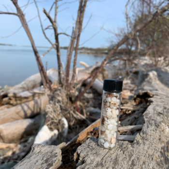
Nurdle Patrol
Tiny plastic pieces create big problems for aquatic ecosystems
Found in many forms in our everyday life, plastic is a lightweight, durable material that can be made into almost anything.
Plastics are polymers, which are modeled after naturally occurring polymers like in hair, skin, and DNA. Most plastic is made of synthetic polymers derived from fossil fuels, a non-renewable resource. Plastics degrade over time. This process is accelerated when the plastic is exposed to heat, light, chemicals or natural processes.
Chemical additives are often mixed into the plastic polymer to slow this breakdown. These additives are not chemically bound to the polymer and they can leach out into the environment in certain conditions.
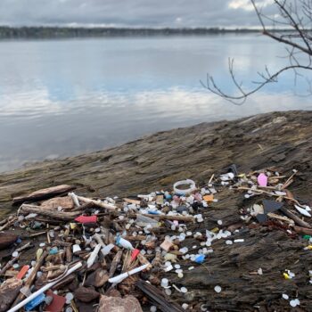
Plastic use and production has increased over time, specifically in the Post-World War II era with increased consumerism and the mass production of goods. Currently, nearly 8.8 billion pounds of plastic is produced each year, of which less than 10% is recycled. By 2015, humans had generated 8.3 billion tons of plastics. The negative impacts can be seen worldwide, specifically in water ecosystems, with numerous species of birds, turtles, and fish becoming entangled in or ingesting plastic material. Often, the plastics being ingested are tiny microplastics, smaller than 5mm in length. Studies have estimated that microplastics make up approximately 90% of plastic pollution in marine environments.
In addition to the plastic pollution at the end of the material life cycle, the generation of plastic materials contributes to atmospheric pollution and relies on non-renewable fossil fuels. New ethane cracker facilities and existing petrochemical plants are often located in poor, minority communities, contributing to environmental justice challenges
In the summer of 2020, a large concentration of nurdles was documented along the banks of the Niagara River in Gratwick Park in North Tonawanda. After this discovery, Waterkeeper joined a larger North American wide citizen science project known as Nurdle Patrol. To learn more about this project visit:
nurdlepatrol.org.
Nurdles are plastic pellets, about the size of a lentil, that are the raw material used in the manufacturing of plastic products. Nurdles get shipped around the world via ship, train, and truck to plastic manufacturers. Nurdles have been known to spill due to transport issues or escape through holes in shipping containers. The small, lightweight nurdles can then be blown by the wind, washed away down storm drains, or directly into waterways.
In 2023, 3,000 nurdles were collected locally and the data was uploaded to the Nurdle Patrol Project. The majority of these nurdles were collected along the Niagara River shoreline at Gratwick Park in North Tonawanda. Waterkeeper was able to train 50 additional volunteers on the nurdle patrol data collection process.
Data collected through Nurdle Patrol was utilized in plastic reduction advocacy efforts this year, as Waterkeeper took a stance of opposition to a proposed new plastic plant in Lockport that would ship in nurdles to create single-use plastic items like utensils and food containers.
Take Action! The Great Lakes system, which includes the Niagara River, provides drinking water for nearly 40 million people, including nearly 1 million residents here in Western New York.3 To protect our water resources, wildlife, and human health, the production of plastics intended for wasteful single-use applications must be reduced. Individuals can conduct an audit of the plastics used in their daily life, and can also advocate to elected officials to support policy that limits the production of single-use plastics.
If you are interested in joining Waterkeeper in our Nurdle Patrol efforts, send an email to Brittni Anderson at banderson@bnwaterkeeper.org so you can be informed about future training opportunities
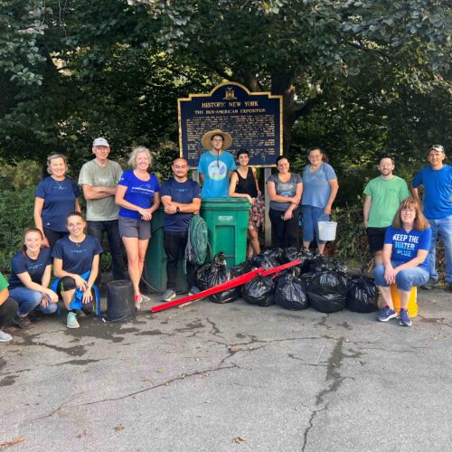
Cleanup Program
The 2023 Spring Sweep was part of the 3rd Great Lakes CleanUP! Waterkeeper initially received federal funding from the EPA Great Lakes Restoration Initiative in 2021 to launch and coordinate this watershed-wide trash removal event in the spring to protect local waterways and strengthen collaborative efforts throughout the Great Lakes. Since then, BNW has continued to grow this partnership each year and now connects with 21 local organizations who organize cleanups in their regions to remove litter and encourage data collection. In 2023, 7,256 volunteers throughout the Great Lakes participated and collected data on 133,240 pounds of litter that was removed across all 5 Great Lakes.
In Western New York, over 1,300 volunteers participated in Waterkeeper’s Spring Sweep, part of the Great Lakes CleanUP. Together these volunteers collected 18,920 pounds of litter. Volunteers were encouraged to input data on litter collected into the Ocean Conservancy’s Clean Swell app. Over 54,000 pieces were recorded! Of these items recorded in Clean Swell, 81% were plastic.
The total numbers collected are staggering!
• 8,237 cigarette butts
• 4,347 food wrappers
• 3,990 bottle caps (metal)
• 3,414 bottle caps (plastic)
The stewardship efforts of volunteers also support Waterkeeper’s advocacy work through the power of data collection.
Learn more about the Great Lakes CleanUP at greatlakescleanup.org/
Scajaquada Sweep
BNW has dedicated the month of September to recognize the history and promote the vision of restoration for Scajaquada Creek. This 13-mile waterway has a long history of water quality issues stemming from urban stormwater runoff and lack of riparian vegetation and pollution. On September 7th we hosted our 4th annual Scajaquada Sweep. This Sweep is part of the International Coastal Cleanup, led by the Ocean Conservancy. Our volunteers were able to collect 202.4 lbs of litter. Learn about this work and the vision for a holistic restoration of the creek at:
www.bnwaterkeeper.org/scajaquada/
Sweep volunteers celebrate a job well done.
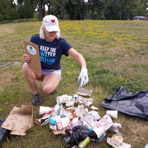
Solo Sweeps
Our Solo Sweep Program continued in 2023, gaining 50 new supporters. The number of solo sweeps recorded this year reached over 200, with 24,000 pieces of litter being recorded in the Clean Swell app.
This data, recorded by solo sweep volunteers, is critical to plastic pollution prevention advocacy and magnifies the impact beyond the removal effort. Clean Swell data is stored on the largest litter database in the world, TIDES, which is used by educators, scientists, and decision makers to advocate for policies that protect clean water.
A wonderful example includes the NYS Attorney General utilizing cleanup data to file a lawsuit against PepsiCo, holding them accountable for their plastic products found along the Buffalo River, jeopardizing the environment and public health.
Learn more about the Solo Sweep Program, and sign the pledge here: www.bnwaterkeeper.org/solo-sweep/
SOLUTIONS TO ONGOING POLLUTION
You can help reduce stormwater and sewage pollution!
Below are three different green or living infrastructure solutions you can apply at your home to reduce stormwater runoff.
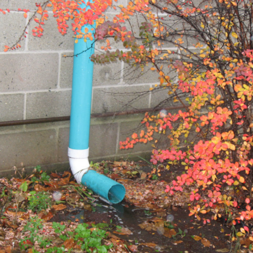
Downspout Disconnection
Downspouts on many homes are connected directly to the sewer system, contributing
to sewer overflows. By disconnecting downspouts from the sewer system, water
is able to drain to lawns or gardens, thereby allowing water to soak slowly into the ground as plants and soils filter out pollutants.
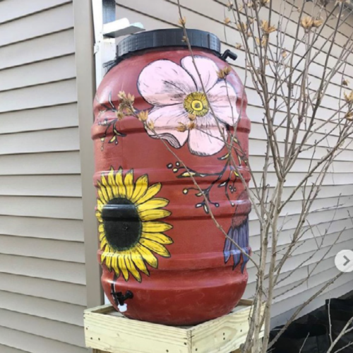
Rain Barrels
Rain barrels are containers that collect and store rain water for future uses (like watering a garden) while decreasing the amount of stormwater runoff that leaves your property. A rain barrel is placed under the downspout to channel rainwater into the barrel for later use. You can purchase one at our office or at various events we attend during the year!
Learn more: bnwaterkeeper.org/rainbarrels/
Reduce Single-Use Plastics
Plastic continues to litter our waterway shorelines and communities. By switching from single-use plastic items to reusable wherever possible, you can help reduce plastic pollution! Another way to help is to call your elected officials and let them know you support legislation that limits single-use plastic pollution! Learn about more tips to reduce plastic waste here: bnwaterkeeper.org/less-plastic/
PREVENT POLLUTION WITH BUFFALO NIAGARA WATERKEEPER
Waterkeeper hosts various volunteer events to clean up local waterways and prevent pollution.
Cleanup Programs
Targeting shoreline sites, thousands of volunteers come out each year to engage in direct action by picking up litter and other debris. These volunteer efforts make our community a better place and reconnect the public with the region’s most valued asset – our water. Get involved:
bnwaterkeeper.org/cleanups/
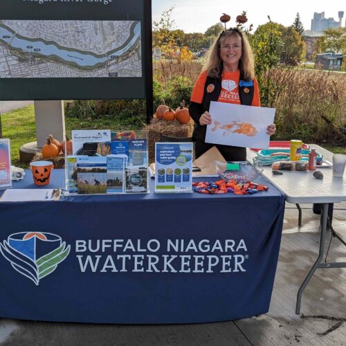
Become a Volunteer Ambassador
The Volunteer Ambassador Program raises community awareness of water pollution issues in Western New York and direct actions to reduce pollution. Ambassadors are highly trained volunteers who represent the organization at various community, school, and organization events and programs. Learn more:
bnwaterkeeper.org/ambassadors/
RestoreCorps
Learn about riparian and park reforestation and adaptive management of shoreline restoration sites while helping reduce stormwater runoff from entering local waterways. These plants also absorb excess nutrients, stop litter from blowing directly into the water, and provide habitat for wildlife! Check the schedule of events: bnwaterkeeper.org/restorecorps/
Thanks for your support!
The Riverwatch Citizen Science Volunteer Program would not be possible without the dedication of our amazing volunteers. Thank you for the countless hours of dedication to Buffalo Niagara Waterkeeper, the Riverwatch Citizen Science Program, and to our freshwater resources!
Thank you to our 2023 program supporters: East Hill Foundation, Community Foundation for Greater Buffalo, funding secured by Congressman Brian Higgins in the federal budget, Ralph C. Wilson, Jr. Foundation, C.S. Mott Foundation and the M&T Charitable Foundation.